
74 Bus Route Map
View the 74 route map and see all 74 stops along the route. The map of 74 shows where the bus travels and the location of each stop, making it easy to understand the entire route at a glance.
Explore Electra Afikim routes on the map and see where Electra Afikim bus services operate. Use the 74 map to find bus stops and see how the 74 connects different areas along its trip.
All 74 stops on the map are displayed in route order, helping you follow the 74 bus from the first stop to the last.
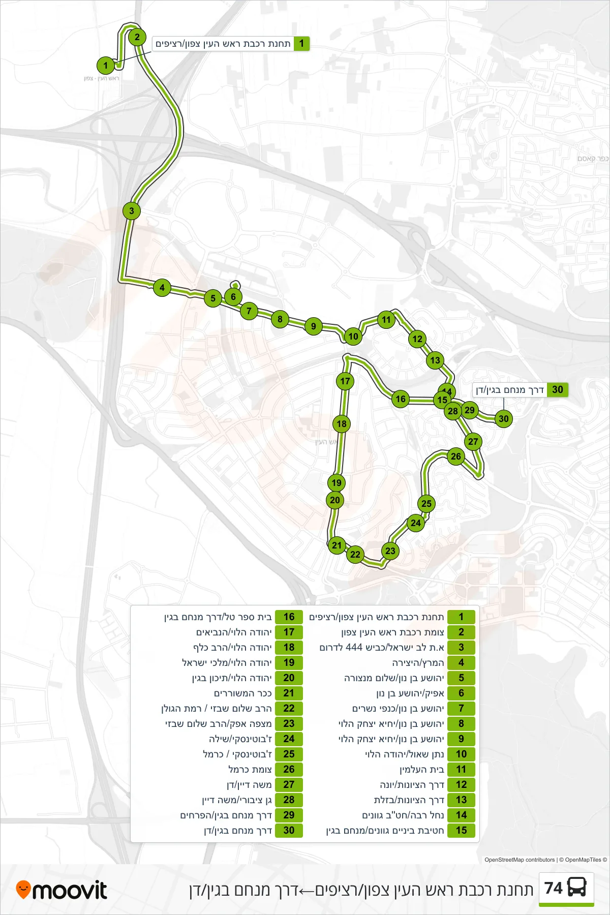
Stops list (74 - Rosh HaAyin North Railway Station/Platforms→Menachem Begin Road/Dan)
- Rosh HaAyin North Railway Station/Platforms
- Rosh HaAyin North Railway Junction
- Lev Israel Industrial/Road 444 South
- HaMeretz/HaYetzira
- Yehoshua Bin Nun/Shalom Mantzura
- Afik/Yehoshua Bin Nun
- Yehoshua Bin Nun/Kanfei Nesharim
- Yehoshua Bin Nun/Yehia Yitzhak HaLevi
- Yehoshua Bin Nun/Yehia Yitzhak HaLevi
- Nathan Shaul/Yehuda HaLevi
- Cemetery
- Derech HaTziyonut/Yona
- Hatzionut Road/Bazelet
- Nachal Raba/Gvanim Middle School
- Gvanim Middle School/Menachem Begin
- Tal School/Menachem Begin Road
- Yehuda Halevi/HaNeviim
- Yehuda HaLevi/Rabbi Kalaf
- Yehuda Halevi/Malchei Israel
- Yehuda HaLevi/Begin High School
- Poets Square
- Rabbi Shalom Shabazi/Ramat HaGolan
- Mitzpe Afek/Rabbi Shalom Shabazi
- Jabotinsky/Shilo
- Jabotinsky/Carmel
- Carmel Junction
- Moshe Dayan/Dan
- Public Garden/Moshe Dayan
- Menachem Begin Road/HaPrachim
- Menachem Begin Road/Dan