
74 Bus Route Map
View the 74 route map and see all 74 stops along the route. The map of 74 shows where the bus travels and the location of each stop, making it easy to understand the entire route at a glance.
Explore Regionalverkehr Main-Kinzig GmbH routes on the map and see where Regionalverkehr Main-Kinzig GmbH bus services operate. Use the 74 map to find bus stops and see how the 74 connects different areas along its trip.
All 74 stops on the map are displayed in route order, helping you follow the 74 bus from the first stop to the last.
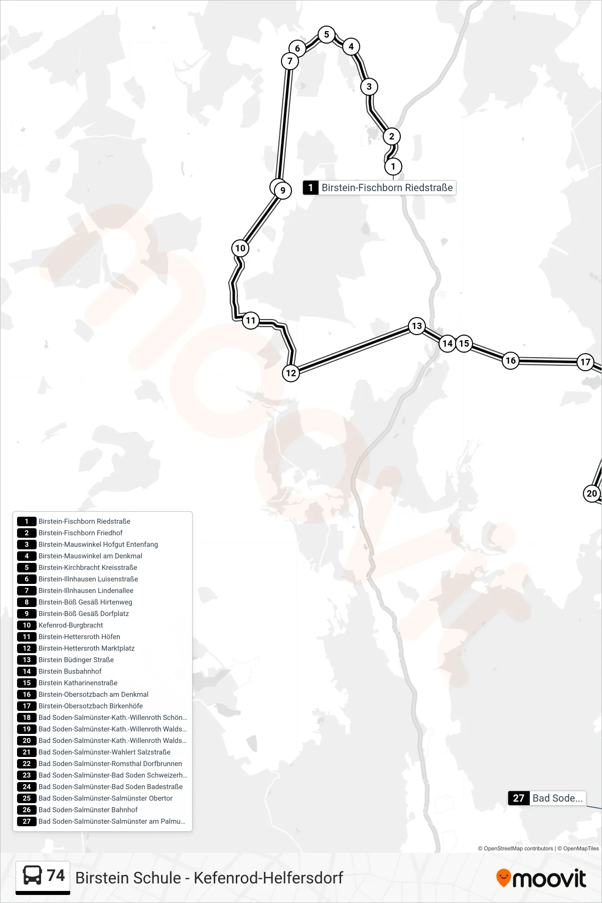
Stops list (74 - Bad Soden-Salmünster-Salmünster am Palmusacker)
- Birstein-Fischborn Riedstraße
- Birstein-Fischborn Friedhof
- Birstein-Mauswinkel Hofgut Entenfang
- Birstein-Mauswinkel am Denkmal
- Birstein-Kirchbracht Kreisstraße
- Birstein-Illnhausen Luisenstraße
- Birstein-Illnhausen Lindenallee
- Birstein-Böß Gesäß Hirtenweg
- Birstein-Böß Gesäß Dorfplatz
- Kefenrod-Burgbracht
- Birstein-Hettersroth Höfen
- Birstein-Hettersroth Marktplatz
- Birstein Büdinger Straße
- Birstein Busbahnhof
- Birstein Katharinenstraße
- Birstein-Obersotzbach am Denkmal
- Birstein-Obersotzbach Birkenhöfe
- Bad Soden-Salmünster-Kath.-Willenroth Schönhof
- Bad Soden-Salmünster-Kath.-Willenroth Waldschule
- Bad Soden-Salmünster-Kath.-Willenroth Waldschulstr
- Bad Soden-Salmünster-Wahlert Salzstraße
- Bad Soden-Salmünster-Romsthal Dorfbrunnen
- Bad Soden-Salmünster-Bad Soden Schweizerhaus
- Bad Soden-Salmünster-Bad Soden Badestraße
- Bad Soden-Salmünster-Salmünster Obertor
- Bad Soden-Salmünster Bahnhof
- Bad Soden-Salmünster-Salmünster am Palmusacker
Change direction
- Route Map - 74 - Bad Soden-Salmünster-Salmünster Harnischfegerschule
- Route Map - 74 - Brachttal-Neuenschmidten Schule
- Route Map - 74 - Kefenrod-Helfersdorf
- Route Map - 74 - Birstein Schule
- Route Map - 74 - Birstein Schule
- Route Map - 74 - Bad Soden-Salmünster Bahnhof
- Route Map - 74 - Birstein-Fischborn Riedstraße
- Route Map - 74 - Kefenrod-Helfersdorf
- Route Map - 74 - Brachttal-Neuenschmidten Schule
- Route Map - 74 - Birstein-Hettersroth Schule
- Route Map - 74 - Birstein Busbahnhof