
74 Bus Route Map
View the 74 route map and see all 74 stops along the route. The map of 74 shows where the bus travels and the location of each stop, making it easy to understand the entire route at a glance.
Explore Autobuses routes on the map and see where Autobuses bus services operate. Use the 74 map to find bus stops and see how the 74 connects different areas along its trip.
All 74 stops on the map are displayed in route order, helping you follow the 74 bus from the first stop to the last.
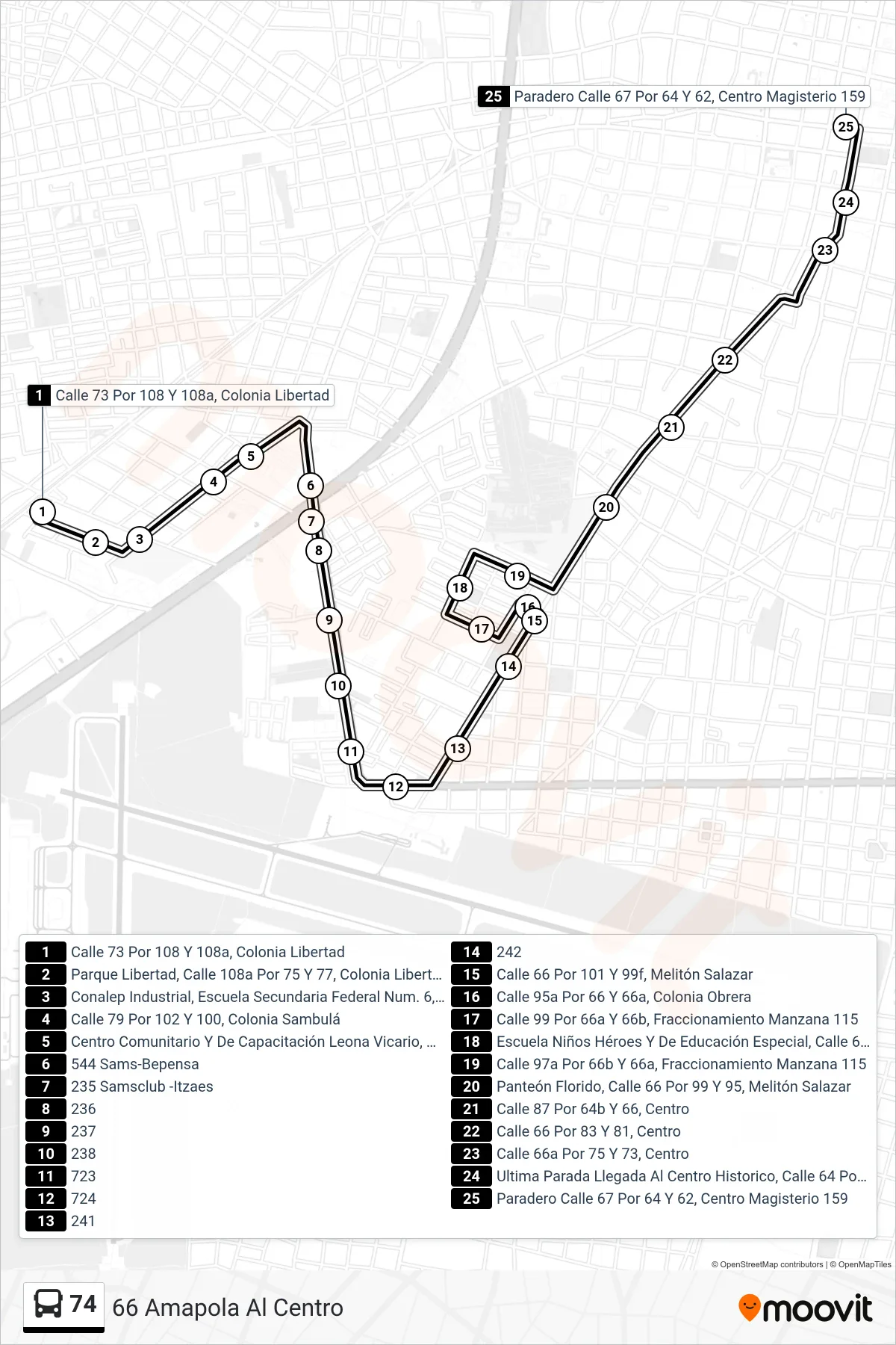
Stops list (74 - 66 Amapola Al Centro)
- Calle 73 Por 108 Y 108a, Colonia Libertad
- Parque Libertad, Calle 108a Por 75 Y 77, Colonia Libertad
- Conalep Industrial, Escuela Secundaria Federal Num. 6, Calle 79 Por 108, Col. Libertad
- Calle 79 Por 102 Y 100, Colonia Sambulá
- Centro Comunitario Y De Capacitación Leona Vicario, Calle 98 Por 100, Colonia Sambulá
- 544 Sams-Bepensa
- 235 Samsclub -Itzaes
- 236
- 237
- 238
- 723
- 724
- 241
- 242
- Calle 66 Por 101 Y 99f, Melitón Salazar
- Calle 95a Por 66 Y 66a, Colonia Obrera
- Calle 99 Por 66a Y 66b, Fraccionamiento Manzana 115
- Escuela Niños Héroes Y De Educación Especial, Calle 66c Por 97e Y 97d, Fraccionamiento Manzana 115
- Calle 97a Por 66b Y 66a, Fraccionamiento Manzana 115
- Panteón Florido, Calle 66 Por 99 Y 95, Melitón Salazar
- Calle 87 Por 64b Y 66, Centro
- Calle 66 Por 83 Y 81, Centro
- Calle 66a Por 75 Y 73, Centro
- Ultima Parada Llegada Al Centro Historico, Calle 64 Por 73 Y 71, Centro
- Paradero Calle 67 Por 64 Y 62, Centro Magisterio 159