
748 Bus Route Map
View the 748 route map and see all 748 stops along the route. The map of 748 shows where the bus travels and the location of each stop, making it easy to understand the entire route at a glance.
Explore bkr-mobility & DB Regio Bus Mitte routes on the map and see where bkr-mobility & DB Regio Bus Mitte bus services operate. Use the 748 map to find bus stops and see how the 748 connects different areas along its trip.
All 748 stops on the map are displayed in route order, helping you follow the 748 bus from the first stop to the last.
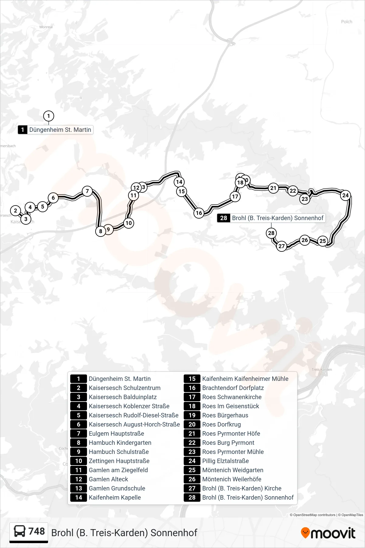
Stops list (748 - Brohl (B. Treis-Karden) Sonnenhof)
- Düngenheim St. Martin
- Kaisersesch Schulzentrum
- Kaisersesch Balduinplatz
- Kaisersesch Koblenzer Straße
- Kaisersesch Rudolf-Diesel-Straße
- Kaisersesch August-Horch-Straße
- Eulgem Hauptstraße
- Hambuch Kindergarten
- Hambuch Schulstraße
- Zettingen Hauptstraße
- Gamlen am Ziegelfeld
- Gamlen Alteck
- Gamlen Grundschule
- Kaifenheim Kapelle
- Kaifenheim Kaifenheimer Mühle
- Brachtendorf Dorfplatz
- Roes Schwanenkirche
- Roes Im Geisenstück
- Roes Bürgerhaus
- Roes Dorfkrug
- Roes Pyrmonter Höfe
- Roes Burg Pyrmont
- Roes Pyrmonter Mühle
- Pillig Elztalstraße
- Möntenich Weidgarten
- Möntenich Weilerhöfe
- Brohl (B. Treis-Karden) Kirche
- Brohl (B. Treis-Karden) Sonnenhof