
74A S-Bahn Route Map
View the 74A route map and see all 74A stops along the route. The map of 74A shows where the S-Bahn travels and the location of each stop, making it easy to understand the entire route at a glance.
Explore Regionalverkehr Main-Kinzig GmbH routes on the map and see where Regionalverkehr Main-Kinzig GmbH S-Bahn services operate. Use the 74A map to find S-Bahn stations and see how the 74A connects different areas along its trip.
All 74A stops on the map are displayed in route order, helping you follow the 74A S-Bahn from the first station to the last.
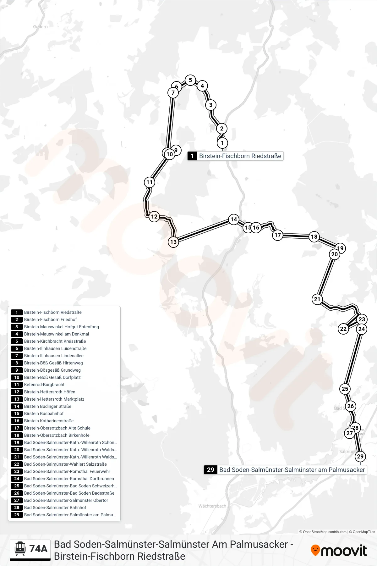
Stops list (74A - Bad Soden-Salmünster-Salmünster am Palmusacker)
- Birstein-Fischborn Riedstraße
- Birstein-Fischborn Friedhof
- Birstein-Mauswinkel Hofgut Entenfang
- Birstein-Mauswinkel am Denkmal
- Birstein-Kirchbracht Kreisstraße
- Birstein-Illnhausen Luisenstraße
- Birstein-Illnhausen Lindenallee
- Birstein-Böß Gesäß Hirtenweg
- Birstein-Bösgesäß Grundweg
- Birstein-Böß Gesäß Dorfplatz
- Kefenrod-Burgbracht
- Birstein-Hettersroth Höfen
- Birstein-Hettersroth Marktplatz
- Birstein Büdinger Straße
- Birstein Busbahnhof
- Birstein Katharinenstraße
- Birstein-Obersotzbach Alte Schule
- Birstein-Obersotzbach Birkenhöfe
- Bad Soden-Salmünster-Kath.-Willenroth Schönhof
- Bad Soden-Salmünster-Kath.-Willenroth Waldschule
- Bad Soden-Salmünster-Kath.-Willenroth Waldschulstr
- Bad Soden-Salmünster-Wahlert Salzstraße
- Bad Soden-Salmünster-Romsthal Feuerwehr
- Bad Soden-Salmünster-Romsthal Dorfbrunnen
- Bad Soden-Salmünster-Bad Soden Schweizerhaus
- Bad Soden-Salmünster-Bad Soden Badestraße
- Bad Soden-Salmünster-Salmünster Obertor
- Bad Soden-Salmünster Bahnhof
- Bad Soden-Salmünster-Salmünster am Palmusacker