
75 Bus Route Map
View the 75 route map and see all 75 stops along the route. The map of 75 shows where the bus travels and the location of each stop, making it easy to understand the entire route at a glance.
Explore De Lijn routes on the map and see where De Lijn bus services operate. Use the 75 map to find bus stops and see how the 75 connects different areas along its trip.
All 75 stops on the map are displayed in route order, helping you follow the 75 bus from the first stop to the last.
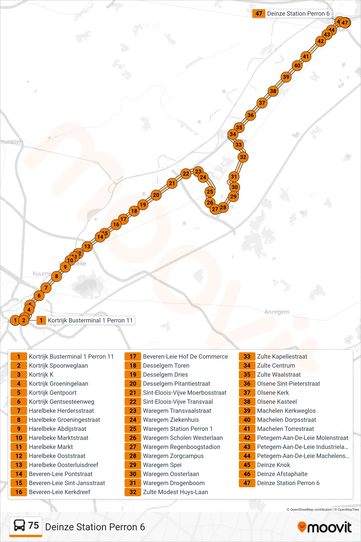
Stops list (75 - Deinze Station Platform 6)
- Kortrijk Bus Terminal 1 Platform 11
- Kortrijk Railway Avenue
- Kortrijk K
- Kortrijk Groeningen Avenue
- Kortrijk Ghent Gate
- Kortrijk Ghent Highway
- Harelbeke Shepherds Street
- Harelbeke Groeninge Street
- Harelbeke Abbey Street
- Harelbeke Market Street
- Harelbeke Market
- Harelbeke East Street
- Harelbeke East Luis Drive
- Beveren-Leie Bridge Street
- Beveren-Leie St. John Street
- Beveren-Leie Church Drive
- Beveren-Leie Commerce Court
- Desselgem Tower
- Desselgem Commons
- Desselgem Pitantie Street
- Sint-Eloois-Vijve Moerbosstraat
- Sint-Eloois-Vijve Transvaal
- Waregem Transvaal Street
- Waregem Hospital
- Waregem Station Platform 1
- Waregem Schools West Avenue
- Waregem Rainbow Stadium
- Waregem Care Campus
- Waregem Spei
- Waregem East Lane
- Waregem Drogenboom
- Zulte Modest Huys Avenue
- Zulte Chapel Street
- Zulte Center
- Zulte Waal Street
- Olsene Saint Peter Street
- Olsene Church
- Olsene Castle
- Machelen Church Path
- Machelen Village Street
- Machelen Tower Street
- Petegem-on-Leie Mill Street
- Petegem Industrial Avenue
- Petegem-Aan-De-Leie Machelen Street
- Deinze Knok
- Deinze Drop-off Point
- Deinze Station Platform 6