
75 Tram Route Map
View the 75 route map and see all 75 stops along the route. The map of 75 shows where the tram travels and the location of each stop, making it easy to understand the entire route at a glance.
Explore routes on the map and see where tram services operate. Use the 75 map to find tram stations and see how the 75 connects different areas along its trip.
All 75 stops on the map are displayed in route order, helping you follow the 75 tram from the first station to the last.
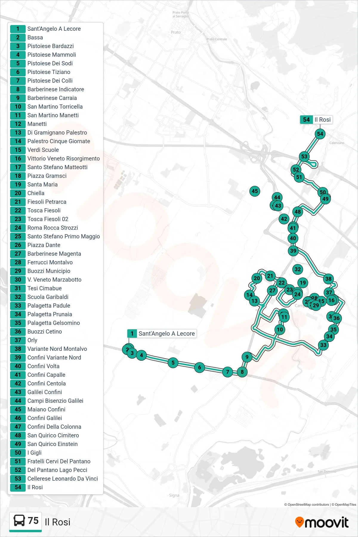

Stops list (75 - Il Rosi)
- Sant'Angelo A Lecore
- Bassa
- Pistoiese Bardazzi
- Pistoiese Mammoli
- Pistoiese Dei Sodi
- Pistoiese Tiziano
- Pistoiese Dei Colli
- Barberinese Indicator
- Barberinese Carraia
- San Martino Torricella
- San Martino Manetti
- Manetti
- Gramignano Palestro
- Palestro Cinque Giornate
- Verdi Schools
- Vittorio Veneto Risorgimento
- Santa Maria
- Chiella
- Fiesoli Petrarca
- Tosca Fiesoli
- Tosca Fiesoli 02
- Roma Rocca Strozzi
- Santo Stefano First of May
- Dante Square
- Barberinese Magenta
- Ferrucci Montalvo
- Santo Stefano Matteotti
- Piazza Gramsci
- Scuola Garibaldi
- Buozzi Town Hall
- Northern Variant Borders
- Palagetta Padule
- Palagetta Prunaia
- Palagetta Gelsomino
- Buozzi Cetino
- Buozzi Rossini
- Via Veneto Marzabotto
- Orly
- Northern Bypass Montalvo
- Confini Volta
- Capalle Borders
- Centola Borders
- Galilei Borders
- Campi Bisenzio Galilei
- Maiano Borders
- Confini Galilei
- Confini Della Colonna
- San Quirico Cemetery
- San Quirico Einstein
- I Gigli
- Fratelli Cervi Del Pantano
- Del Pantano Pecci Lake
- Cellerese Leonardo Da Vinci
- Il Rosi