
750 Bus Route Map
View the 750 route map and see all 750 stops along the route. The map of 750 shows where the bus travels and the location of each stop, making it easy to understand the entire route at a glance.
Explore Movia routes on the map and see where Movia bus services operate. Use the 750 map to find bus stops and see how the 750 connects different areas along its trip.
All 750 stops on the map are displayed in route order, helping you follow the 750 bus from the first stop to the last.
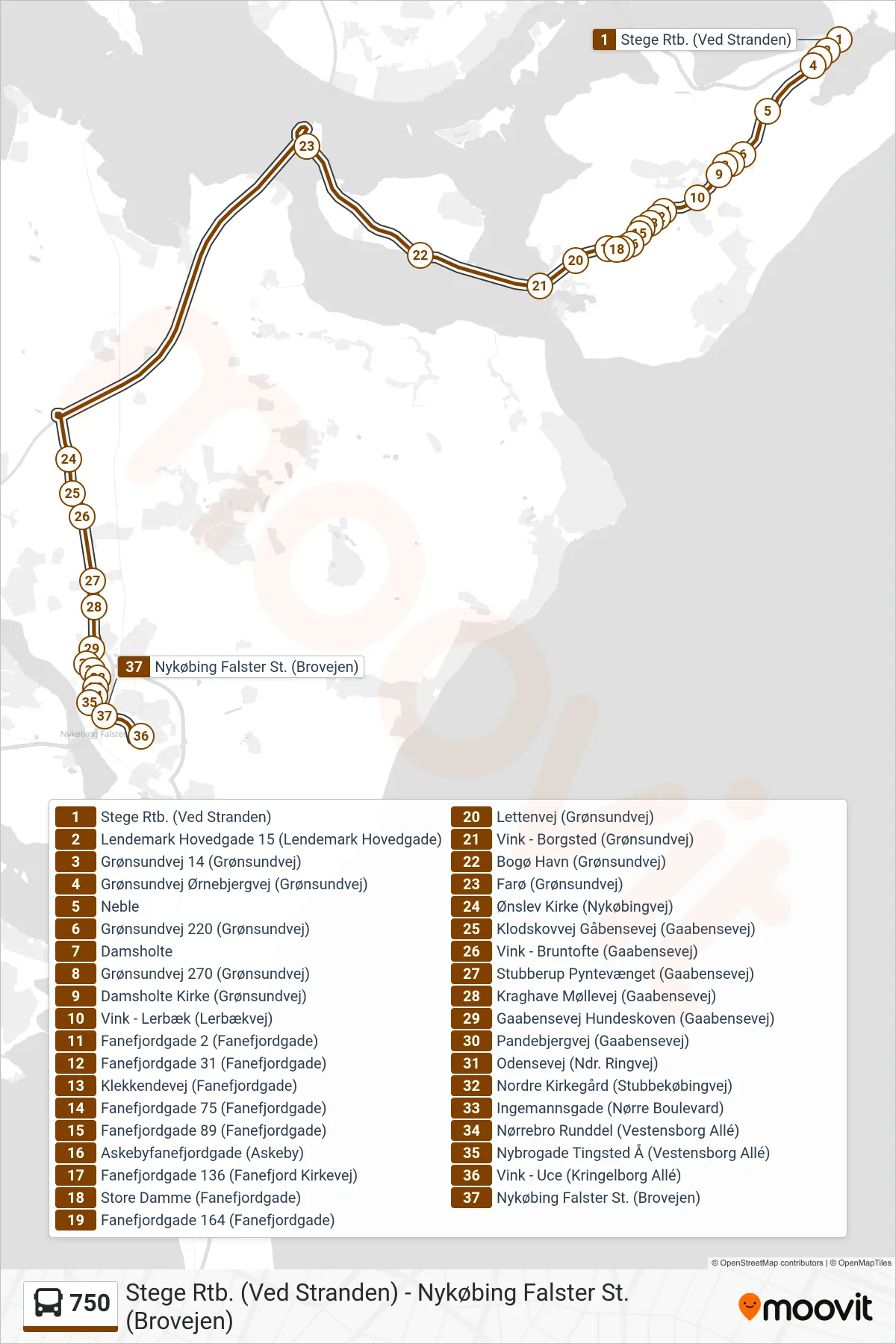
Stops list (750 - Nykøbing F St.)
- Stege Rtb. (Ved Stranden)
- Lendemark Hovedgade 15 (Lendemark Hovedgade)
- Grønsundvej 14 (Grønsundvej)
- Grønsundvej Ørnebjergvej (Grønsundvej)
- Neble
- Grønsundvej 220 (Grønsundvej)
- Damsholte
- Grønsundvej 270 (Grønsundvej)
- Damsholte Kirke (Grønsundvej)
- Vink - Lerbæk (Lerbækvej)
- Fanefjordgade 2 (Fanefjordgade)
- Fanefjordgade 31 (Fanefjordgade)
- Klekkendevej (Fanefjordgade)
- Fanefjordgade 75 (Fanefjordgade)
- Fanefjordgade 89 (Fanefjordgade)
- Askebyfanefjordgade (Askeby)
- Fanefjordgade 136 (Fanefjord Kirkevej)
- Store Damme (Fanefjordgade)
- Fanefjordgade 164 (Fanefjordgade)
- Lettenvej (Grønsundvej)
- Vink - Borgsted (Grønsundvej)
- Bogø Havn (Grønsundvej)
- Farø (Grønsundvej)
- Ønslev Kirke (Nykøbingvej)
- Klodskovvej Gåbensevej (Gaabensevej)
- Vink - Bruntofte (Gaabensevej)
- Stubberup Pyntevænget (Gaabensevej)
- Kraghave Møllevej (Gaabensevej)
- Gaabensevej Hundeskoven (Gaabensevej)
- Pandebjergvej (Gaabensevej)
- Odensevej (Ndr. Ringvej)
- Nordre Kirkegård (Stubbekøbingvej)
- Ingemannsgade (Nørre Boulevard)
- Nørrebro Runddel (Vestensborg Allé)
- Nybrogade Tingsted Å (Vestensborg Allé)
- Vink - Uce (Kringelborg Allé)
- Nykøbing Falster St. (Brovejen)