
768 Bus Route Map
View the 768 route map and see all 768 stops along the route. The map of 768 shows where the bus travels and the location of each stop, making it easy to understand the entire route at a glance.
Explore Verkehrsgesellschaft Teltow Fläming routes on the map and see where Verkehrsgesellschaft Teltow Fläming bus services operate. Use the 768 map to find bus stops and see how the 768 connects different areas along its trip.
All 768 stops on the map are displayed in route order, helping you follow the 768 bus from the first stop to the last.
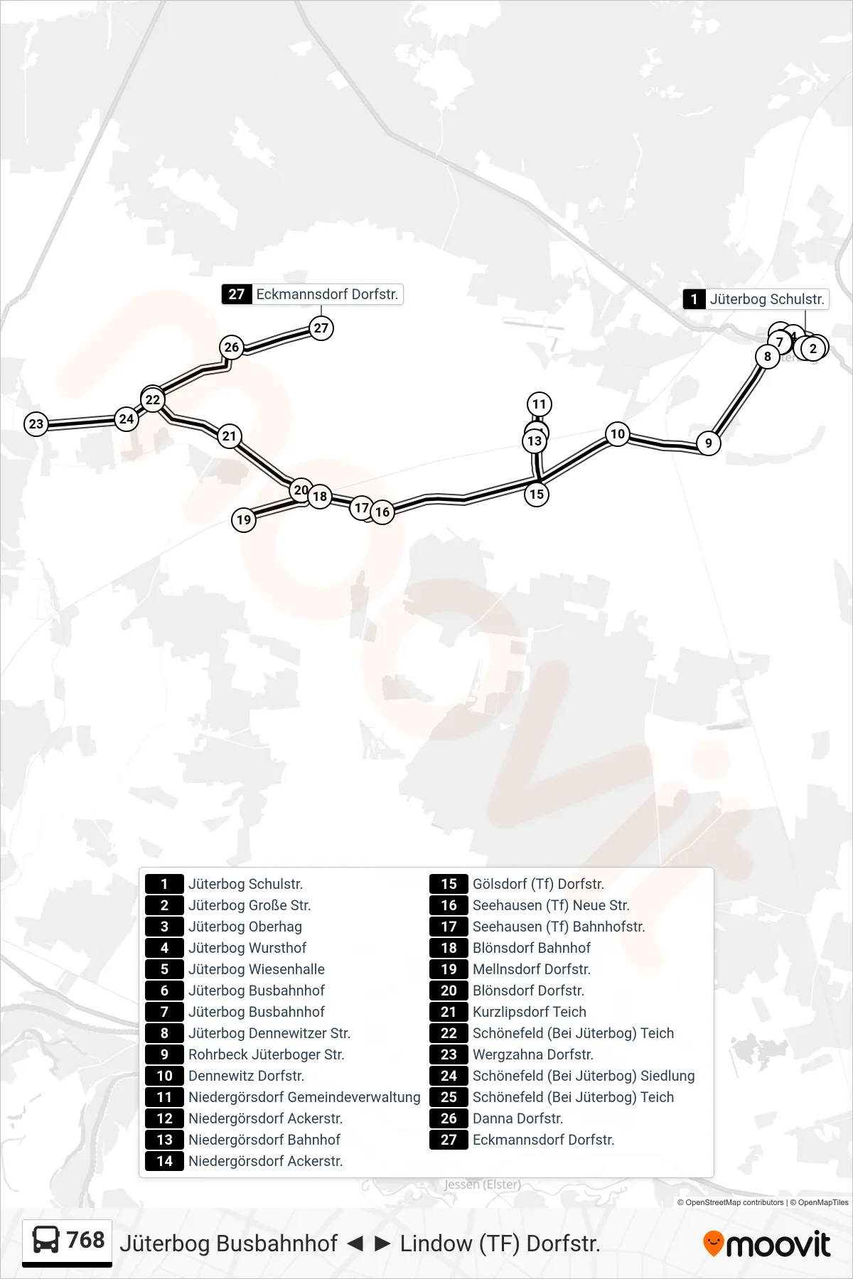
Stops list (768 - Eckmannsdorf Dorfstr.)
- Jüterbog Schulstr.
- Jüterbog Große Str.
- Jüterbog Oberhag
- Jüterbog Wursthof
- Jüterbog Wiesenhalle
- Jüterbog Busbahnhof
- Jüterbog Busbahnhof
- Jüterbog Dennewitzer Str.
- Rohrbeck Jüterboger Str.
- Dennewitz Dorfstr.
- Niedergörsdorf Gemeindeverwaltung
- Niedergörsdorf Ackerstr.
- Niedergörsdorf Bahnhof
- Niedergörsdorf Ackerstr.
- Gölsdorf (Tf) Dorfstr.
- Seehausen (Tf) Neue Str.
- Seehausen (Tf) Bahnhofstr.
- Blönsdorf Bahnhof
- Mellnsdorf Dorfstr.
- Blönsdorf Dorfstr.
- Kurzlipsdorf Teich
- Schönefeld (Bei Jüterbog) Teich
- Wergzahna Dorfstr.
- Schönefeld (Bei Jüterbog) Siedlung
- Schönefeld (Bei Jüterbog) Teich
- Danna Dorfstr.
- Eckmannsdorf Dorfstr.
Change direction
- Route Map - 768 - Jüterbog Busbahnhof
- Route Map - 768 - Lindow (Tf) Dorfstr.
- Route Map - 768 - Blönsdorf Schule
- Route Map - 768 - Altes Lager F.-Engels-Str.
- Route Map - 768 - Jüterbog In den Kaupen
- Route Map - 768 - Blönsdorf Dorfstr.
- Route Map - 768 - Eckmannsdorf Dorfstr.
- Route Map - 768 - Blönsdorf Schule
- Route Map - 768 - Niedergörsdorf Gemeindeverwaltung
- Route Map - 768 - Wergzahna Dorfstr.