
79 Bus Route Map
View the 79 route map and see all 79 stops along the route. The map of 79 shows where the bus travels and the location of each stop, making it easy to understand the entire route at a glance.
Explore Montgomery County Ride On routes on the map and see where Montgomery County Ride On bus services operate. Use the 79 map to find bus stops and see how the 79 connects different areas along its trip.
All 79 stops on the map are displayed in route order, helping you follow the 79 bus from the first stop to the last.
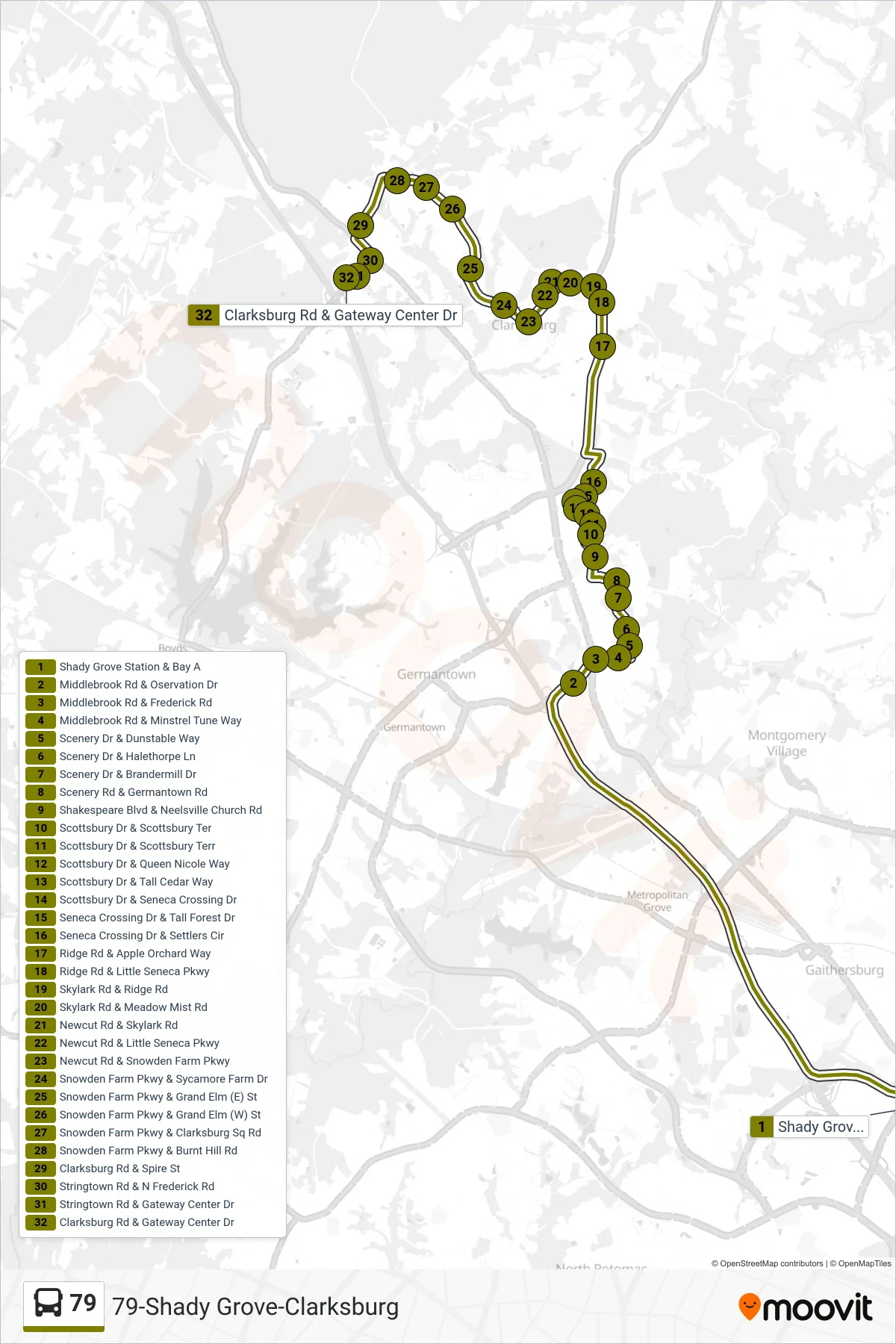
Stops list (79 - Clarksburg)
- Shady Grove Station & Bay A
- Middlebrook Rd & Oservation Dr
- Middlebrook Rd & Frederick Rd
- Middlebrook Rd & Minstrel Tune Way
- Scenery Dr & Dunstable Way
- Scenery Dr & Halethorpe Ln
- Scenery Dr & Brandermill Dr
- Scenery Rd & Germantown Rd
- Shakespeare Blvd & Neelsville Church Rd
- Scottsbury Dr & Scottsbury Ter
- Scottsbury Dr & Scottsbury Terr
- Scottsbury Dr & Queen Nicole Way
- Scottsbury Dr & Tall Cedar Way
- Scottsbury Dr & Seneca Crossing Dr
- Seneca Crossing Dr & Tall Forest Dr
- Seneca Crossing Dr & Settlers Cir
- Ridge Rd & Apple Orchard Way
- Ridge Rd & Little Seneca Pkwy
- Skylark Rd & Ridge Rd
- Skylark Rd & Meadow Mist Rd
- Newcut Rd & Skylark Rd
- Newcut Rd & Little Seneca Pkwy
- Newcut Rd & Snowden Farm Pkwy
- Snowden Farm Pkwy & Sycamore Farm Dr
- Snowden Farm Pkwy & Grand Elm (E) St
- Snowden Farm Pkwy & Grand Elm (W) St
- Snowden Farm Pkwy & Clarksburg Sq Rd
- Snowden Farm Pkwy & Burnt Hill Rd
- Clarksburg Rd & Spire St
- Stringtown Rd & N Frederick Rd
- Stringtown Rd & Gateway Center Dr
- Clarksburg Rd & Gateway Center Dr