
7A Bus Route Map
View the 7A route map and see all 7A stops along the route. The map of 7A shows where the bus travels and the location of each stop, making it easy to understand the entire route at a glance.
Explore SolTrans routes on the map and see where SolTrans bus services operate. Use the 7A map to find bus stops and see how the 7A connects different areas along its trip.
All 7A stops on the map are displayed in route order, helping you follow the 7A bus from the first stop to the last.
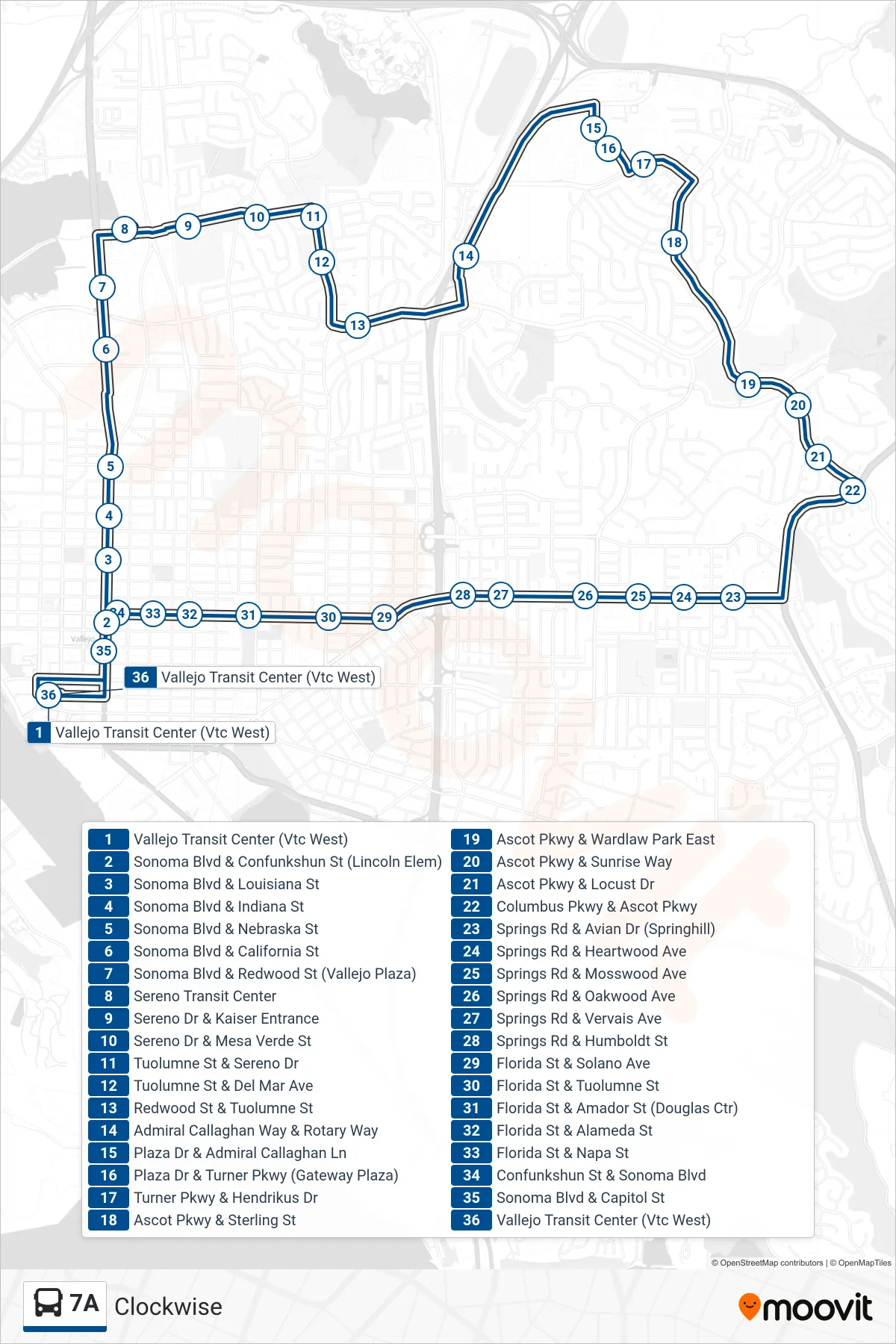
Stops list (7A - Vallejo Transit Center via Vallejo Plaza Shopping Center)
- Vallejo Transit Center (Vtc West)
- Sonoma Blvd & Confunkshun St (Lincoln Elem)
- Sonoma Blvd & Louisiana St
- Sonoma Blvd & Indiana St
- Sonoma Blvd & Nebraska St
- Sonoma Blvd & California St
- Sonoma Blvd & Redwood St (Vallejo Plaza)
- Sereno Transit Center
- Sereno Dr & Kaiser Entrance
- Sereno Dr & Mesa Verde St
- Tuolumne St & Sereno Dr
- Tuolumne St & Del Mar Ave
- Redwood St & Tuolumne St
- Admiral Callaghan Way & Rotary Way
- Plaza Dr & Admiral Callaghan Ln
- Plaza Dr & Turner Pkwy (Gateway Plaza)
- Turner Pkwy & Hendrikus Dr
- Ascot Pkwy & Sterling St
- Ascot Pkwy & Wardlaw Park East
- Ascot Pkwy & Sunrise Way
- Ascot Pkwy & Locust Dr
- Columbus Pkwy & Ascot Pkwy
- Springs Rd & Avian Dr (Springhill)
- Springs Rd & Heartwood Ave
- Springs Rd & Mosswood Ave
- Springs Rd & Oakwood Ave
- Springs Rd & Vervais Ave
- Springs Rd & Humboldt St
- Florida St & Solano Ave
- Florida St & Tuolumne St
- Florida St & Amador St (Douglas Ctr)
- Florida St & Alameda St
- Florida St & Napa St
- Confunkshun St & Sonoma Blvd
- Sonoma Blvd & Capitol St
- Vallejo Transit Center (Vtc West)