
8 Bus Route Map
View the 8 route map and see all 8 stops along the route. The map of 8 shows where the bus travels and the location of each stop, making it easy to understand the entire route at a glance.
Explore River Valley Metro routes on the map and see where River Valley Metro bus services operate. Use the 8 map to find bus stops and see how the 8 connects different areas along its trip.
All 8 stops on the map are displayed in route order, helping you follow the 8 bus from the first stop to the last.
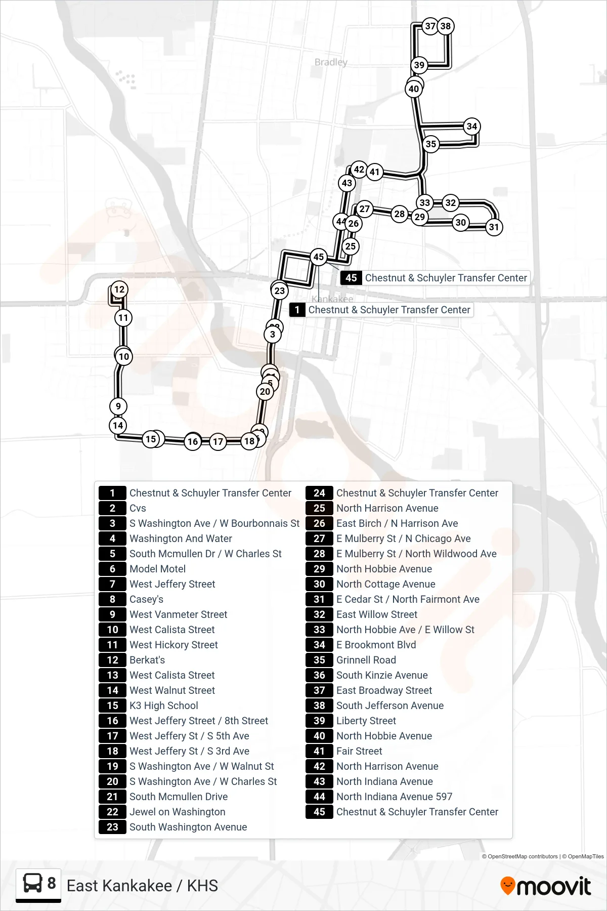
Stops list (8 - East Kankakee / KHS)
- Chestnut & Schuyler Transfer Center
- Cvs
- S Washington Ave / W Bourbonnais St
- Washington And Water
- South Mcmullen Dr / W Charles St
- Model Motel
- West Jeffery Street
- Casey's
- West Vanmeter Street
- West Calista Street
- West Hickory Street
- Berkat's
- West Calista Street
- West Walnut Street
- K3 High School
- West Jeffery Street / 8th Street
- West Jeffery St / S 5th Ave
- West Jeffery St / S 3rd Ave
- S Washington Ave / W Walnut St
- S Washington Ave / W Charles St
- South Mcmullen Drive
- Jewel on Washington
- South Washington Avenue
- Chestnut & Schuyler Transfer Center
- North Harrison Avenue
- East Birch / N Harrison Ave
- E Mulberry St / N Chicago Ave
- E Mulberry St / North Wildwood Ave
- North Hobbie Avenue
- North Cottage Avenue
- E Cedar St / North Fairmont Ave
- East Willow Street
- North Hobbie Ave / E Willow St
- E Brookmont Blvd
- Grinnell Road
- South Kinzie Avenue
- East Broadway Street
- South Jefferson Avenue
- Liberty Street
- North Hobbie Avenue
- Fair Street
- North Harrison Avenue
- North Indiana Avenue
- North Indiana Avenue 597
- Chestnut & Schuyler Transfer Center