
8 Bus Route Map
View the 8 route map and see all 8 stops along the route. The map of 8 shows where the bus travels and the location of each stop, making it easy to understand the entire route at a glance.
Explore Sydtrafik routes on the map and see where Sydtrafik bus services operate. Use the 8 map to find bus stops and see how the 8 connects different areas along its trip.
All 8 stops on the map are displayed in route order, helping you follow the 8 bus from the first stop to the last.
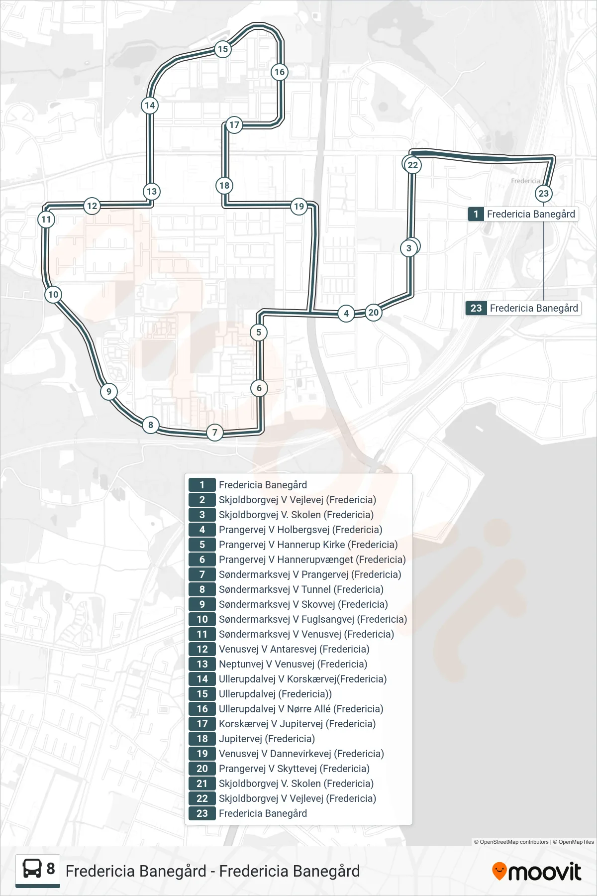
Stops list (8 - Fredericia Banegård)
- Fredericia Banegård
- Skjoldborgvej V Vejlevej (Fredericia)
- Skjoldborgvej V. Skolen (Fredericia)
- Prangervej V Holbergsvej (Fredericia)
- Prangervej V Hannerup Kirke (Fredericia)
- Prangervej V Hannerupvænget (Fredericia)
- Søndermarksvej V Prangervej (Fredericia)
- Søndermarksvej V Tunnel (Fredericia)
- Søndermarksvej V Skovvej (Fredericia)
- Søndermarksvej V Fuglsangvej (Fredericia)
- Søndermarksvej V Venusvej (Fredericia)
- Venusvej V Antaresvej (Fredericia)
- Neptunvej V Venusvej (Fredericia)
- Ullerupdalvej V Korskærvej(Fredericia)
- Ullerupdalvej (Fredericia))
- Ullerupdalvej V Nørre Allé (Fredericia)
- Korskærvej V Jupitervej (Fredericia)
- Jupitervej (Fredericia)
- Venusvej V Dannevirkevej (Fredericia)
- Prangervej V Skyttevej (Fredericia)
- Skjoldborgvej V. Skolen (Fredericia)
- Skjoldborgvej V Vejlevej (Fredericia)
- Fredericia Banegård