
8 Bus Route Map
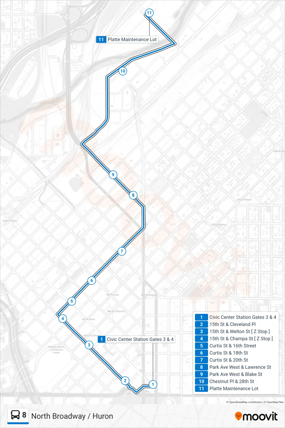
View the 8 route map and see all 8 stops along the route. The map of 8 shows where the bus travels and the location of each stop, making it easy to understand the entire route at a glance.
Explore Regional Transportation District routes on the map and see where Regional Transportation District bus services operate. Use the 8 map to find bus stops and see how the 8 connects different areas along its trip.
All 8 stops on the map are displayed in route order, helping you follow the 8 bus from the first stop to the last.
Stops list (8 - Platte Division)
- Civic Center Station Gates 3 & 4
- 15th St & Cleveland Pl
- 15th St & Welton St [ Z Stop ]
- 15th St & Champa St [ Z Stop ]
- Curtis St & 16th Street
- Curtis St & 18th St
- Curtis St & 20th St
- Park Ave West & Lawrence St
- Park Ave West & Blake St
- Chestnut Pl & 28th St
- Platte Maintenance Lot