
8 Bus Route Map
View the 8 route map and see all 8 stops along the route. The map of 8 shows where the bus travels and the location of each stop, making it easy to understand the entire route at a glance.
Explore Prato and Province - Tuscan Bus Lines routes on the map and see where Prato and Province - Tuscan Bus Lines bus services operate. Use the 8 map to find bus stops and see how the 8 connects different areas along its trip.
All 8 stops on the map are displayed in route order, helping you follow the 8 bus from the first stop to the last.
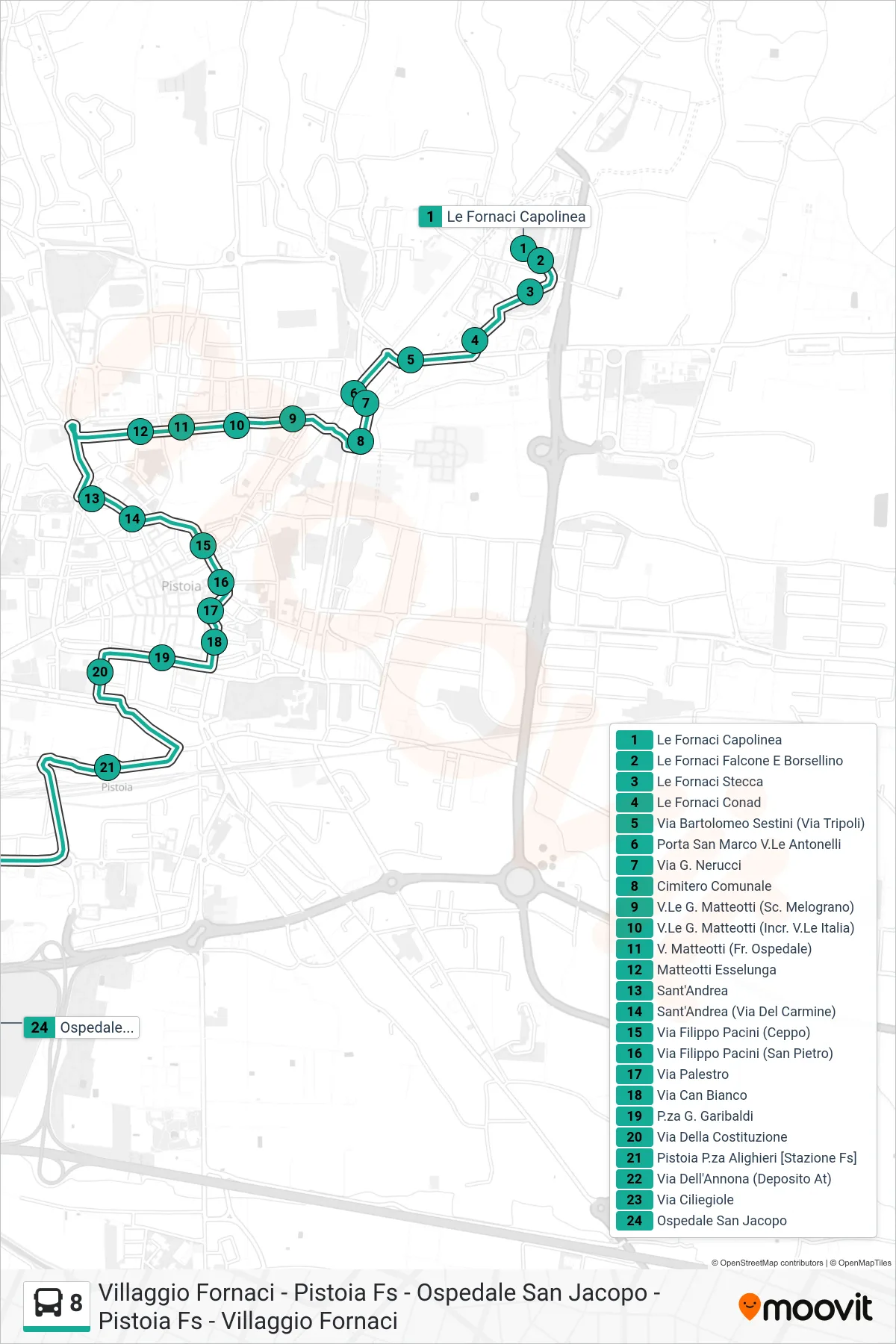
Stops list (8 - San Jacopo Hospital)
- Le Fornaci Terminal
- Le Fornaci Falcone and Borsellino
- Le Fornaci Block
- Le Fornaci Conad
- Via Bartolomeo Sestini (Via Tripoli)
- San Marco Gate Antonelli Avenue
- Via G. Nerucci
- Municipal Cemetery
- G. Matteotti Avenue (Melograno School)
- Matteotti Blvd (Italy Blvd Junction)
- Via Matteotti (Opposite Hospital)
- Matteotti Esselunga
- Sant'Andrea
- Sant'Andrea (Via Del Carmine)
- Via Filippo Pacini (Ceppo)
- Via Filippo Pacini (San Pietro)
- Palestro Street
- Via Can Bianco
- Garibaldi Square
- Della Costituzione Street
- Pistoia Alighieri Square [Railway Station]
- Via Dell'Annona (AT Depot)
- Via Ciliegiole
- San Jacopo Hospital