
8 Bus Route Map
View the 8 route map and see all 8 stops along the route. The map of 8 shows where the bus travels and the location of each stop, making it easy to understand the entire route at a glance.
Explore RhönEnergie Bus GmbH routes on the map and see where RhönEnergie Bus GmbH bus services operate. Use the 8 map to find bus stops and see how the 8 connects different areas along its trip.
All 8 stops on the map are displayed in route order, helping you follow the 8 bus from the first stop to the last.
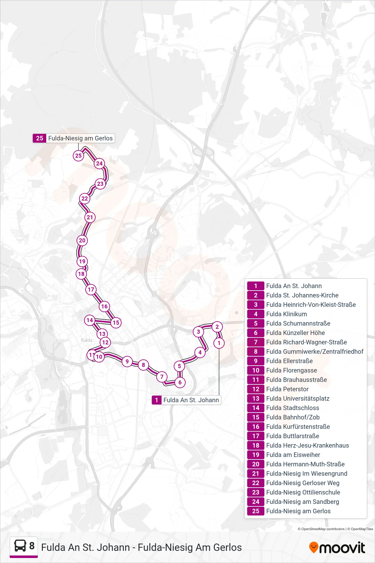
Stops list (8 - Fulda-Niesig am Gerlos)
- Fulda An St. Johann
- Fulda St. Johannes-Kirche
- Fulda Heinrich-Von-Kleist-Straße
- Fulda Klinikum
- Fulda Schumannstraße
- Fulda Künzeller Höhe
- Fulda Richard-Wagner-Straße
- Fulda Gummiwerke/Zentralfriedhof
- Fulda Ellerstraße
- Fulda Florengasse
- Fulda Brauhausstraße
- Fulda Peterstor
- Fulda Universitätsplatz
- Fulda Stadtschloss
- Fulda Bahnhof/Zob
- Fulda Kurfürstenstraße
- Fulda Buttlarstraße
- Fulda Herz-Jesu-Krankenhaus
- Fulda am Eisweiher
- Fulda Hermann-Muth-Straße
- Fulda-Niesig Im Wiesengrund
- Fulda-Niesig Gerloser Weg
- Fulda-Niesig Ottilienschule
- Fulda-Niesig am Sandberg
- Fulda-Niesig am Gerlos