
8 Bus Route Map
View the 8 route map and see all 8 stops along the route. The map of 8 shows where the bus travels and the location of each stop, making it easy to understand the entire route at a glance.
Explore Stadtwerke Trier routes on the map and see where Stadtwerke Trier bus services operate. Use the 8 map to find bus stops and see how the 8 connects different areas along its trip.
All 8 stops on the map are displayed in route order, helping you follow the 8 bus from the first stop to the last.
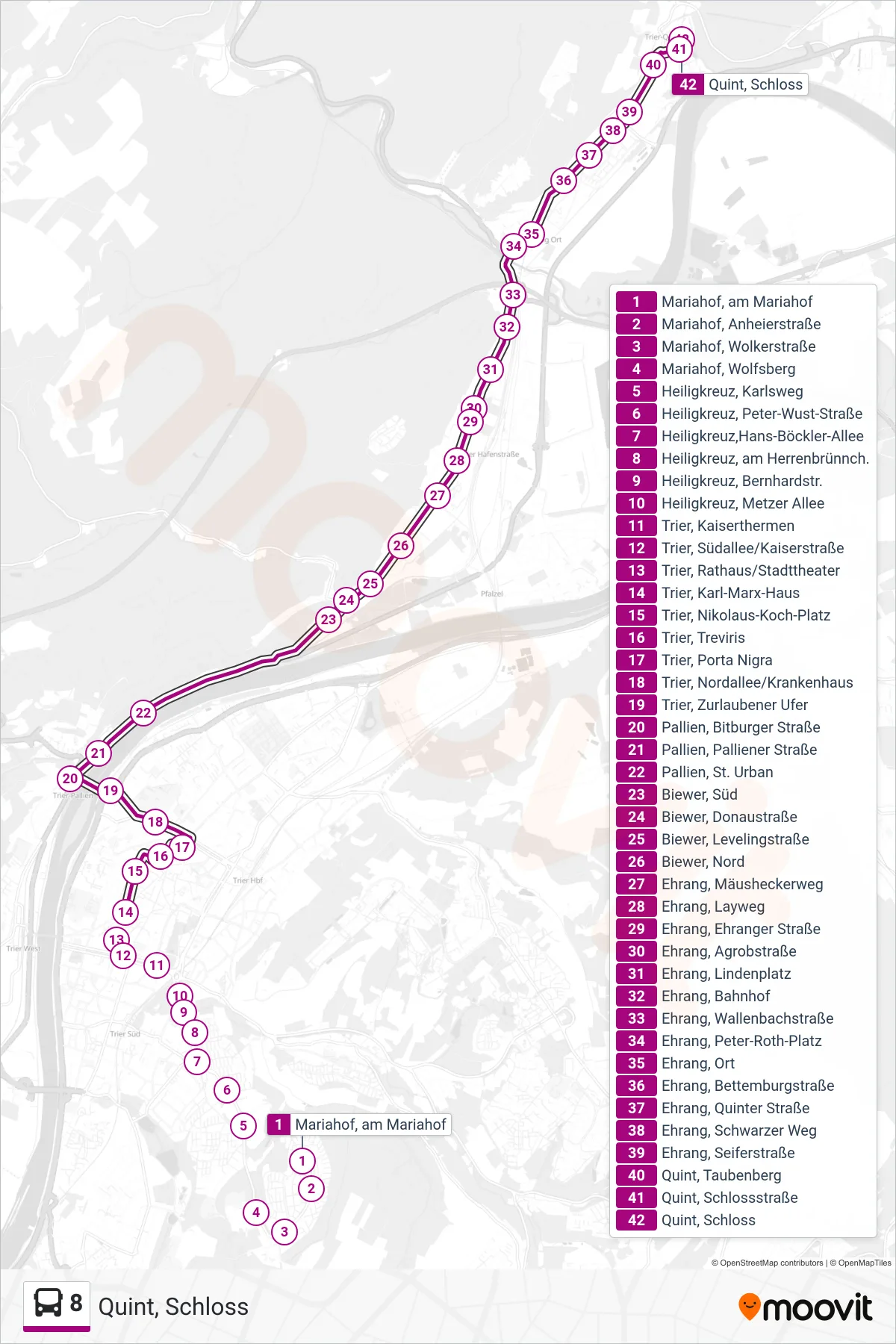
Stops list (8 - Quint, Schloss)
- Mariahof, am Mariahof
- Mariahof, Anheierstraße
- Mariahof, Wolkerstraße
- Mariahof, Wolfsberg
- Heiligkreuz, Karlsweg
- Heiligkreuz, Peter-Wust-Straße
- Heiligkreuz,Hans-Böckler-Allee
- Heiligkreuz, am Herrenbrünnch.
- Heiligkreuz, Bernhardstr.
- Heiligkreuz, Metzer Allee
- Trier, Kaiserthermen
- Trier, Südallee/Kaiserstraße
- Trier, Rathaus/Stadttheater
- Trier, Karl-Marx-Haus
- Trier, Nikolaus-Koch-Platz
- Trier, Treviris
- Trier, Porta Nigra
- Trier, Nordallee/Krankenhaus
- Trier, Zurlaubener Ufer
- Pallien, Bitburger Straße
- Pallien, Palliener Straße
- Pallien, St. Urban
- Biewer, Süd
- Biewer, Donaustraße
- Biewer, Levelingstraße
- Biewer, Nord
- Ehrang, Mäusheckerweg
- Ehrang, Layweg
- Ehrang, Ehranger Straße
- Ehrang, Agrobstraße
- Ehrang, Lindenplatz
- Ehrang, Bahnhof
- Ehrang, Wallenbachstraße
- Ehrang, Peter-Roth-Platz
- Ehrang, Ort
- Ehrang, Bettemburgstraße
- Ehrang, Quinter Straße
- Ehrang, Schwarzer Weg
- Ehrang, Seiferstraße
- Quint, Taubenberg
- Quint, Schlossstraße
- Quint, Schloss