
8 Bus Route Map
View the 8 route map and see all 8 stops along the route. The map of 8 shows where the bus travels and the location of each stop, making it easy to understand the entire route at a glance.
Explore ATM Messina routes on the map and see where ATM Messina bus services operate. Use the 8 map to find bus stops and see how the 8 connects different areas along its trip.
All 8 stops on the map are displayed in route order, helping you follow the 8 bus from the first stop to the last.
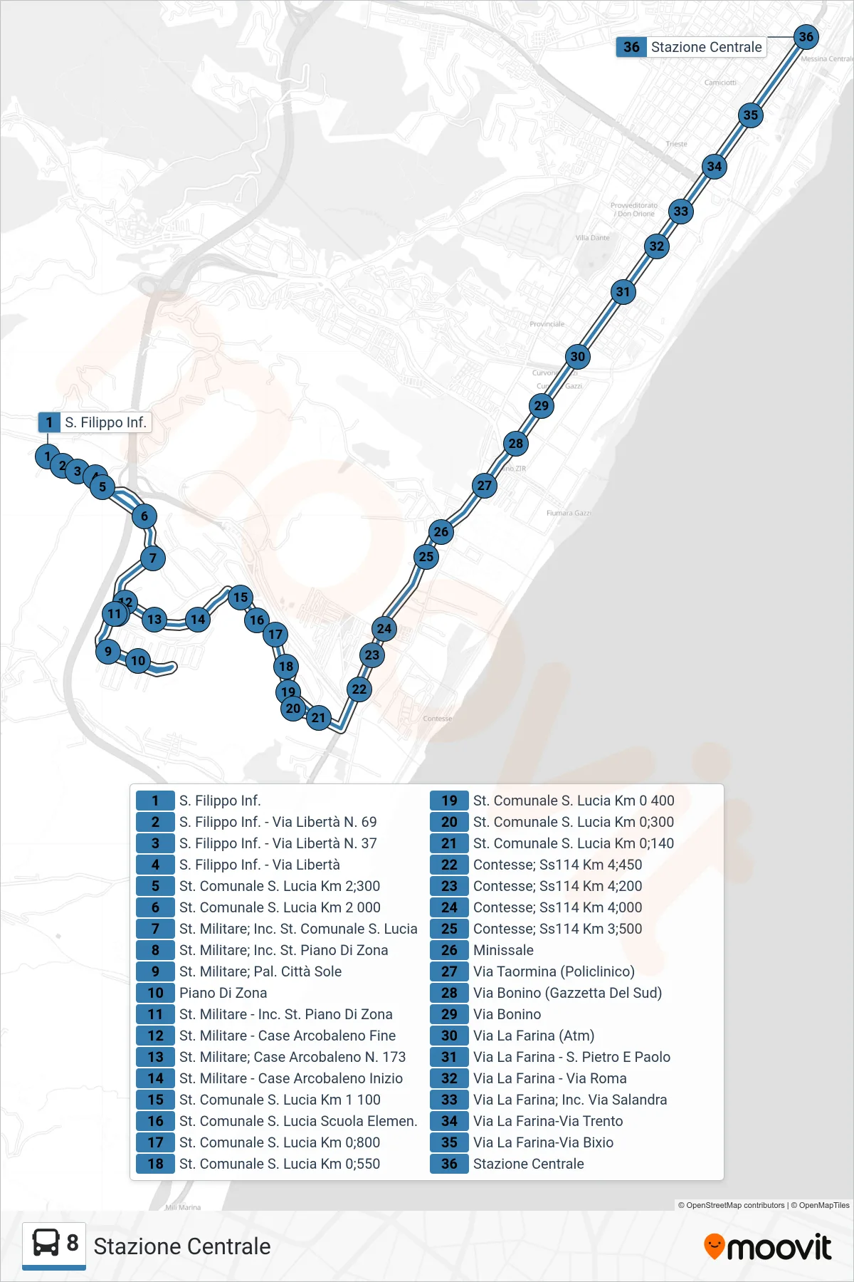
Stops list (8 - Central Station)
- Lower S. Filippo
- St. Filippo Lower - Liberty Street No. 69
- Lower S. Filippo - 37 Liberty Street
- Lower San Filippo - Liberty Street
- Municipal Road S. Lucia Km 2;300
- Municipal Road S. Lucia Km 2 000
- Military Street, Municipal Road S. Lucia Junction
- Military St. Junction Piano Di Zona
- Military Station - City Sun Building
- Development Zone
- Military Street - Piano Di Zona Junction
- Military Road - Rainbow Houses End
- Military St.; Rainbow Houses No. 173
- Military St. - Rainbow Houses Start
- Municipal Road S. Lucia Km 1 100
- St. Lucia Municipal School
- Municipal St. S. Lucia Km 0.800
- Municipal Road St Lucia Km 0.550
- Municipal Road S. Lucia Km 0 400
- Municipal Road St. Lucia Km 0.300
- Municipal Street S. Lucia Km 0.140
- Contesse; State Road 114 Km 4.450
- Contesse; State Road 114 Km 4;200
- Contesse; State Road 114 Km 4.000
- Contesse; State Road 114 Km 3;500
- Minissale
- Via Taormina (Hospital)
- Bonino St. (Gazzetta Del Sud)
- Bonino Street
- La Farina Street (Atm)
- Via La Farina - St. Peter and Paul
- La Farina Street - Roma Street
- Via La Farina - Salandra Street Junction
- Via La Farina-Via Trento
- Via La Farina-Via Bixio
- Central Station