
8 Bus Route Map
View the 8 route map and see all 8 stops along the route. The map of 8 shows where the bus travels and the location of each stop, making it easy to understand the entire route at a glance.
Explore U-OV routes on the map and see where U-OV bus services operate. Use the 8 map to find bus stops and see how the 8 connects different areas along its trip.
All 8 stops on the map are displayed in route order, helping you follow the 8 bus from the first stop to the last.
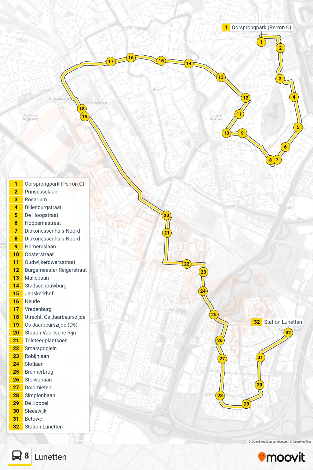
Stops list (8 - Lunetten)
- Oorsprongpark (Perron C)
- Prinsesselaan
- Rosarium
- Dillenburgstraat
- De Hoogstraat
- Hobbemastraat
- Diakonessenhuis-Noord
- Diakonessenhuis-Noord
- Homeruslaan
- Oosterstraat
- Oudwijkerdwarsstraat
- Burgemeester Reigerstraat
- Maliebaan
- Stadsschouwburg
- Janskerkhof
- Neude
- Vredenburg
- Utrecht, Cs Jaarbeurszijde
- Cs Jaarbeurszijde (D5)
- Station Vaartsche Rijn
- Tolsteegplantsoen
- Smaragdplein
- Robijnlaan
- Slotlaan
- Brennerbrug
- Stelviobaan
- Dolomieten
- Simplonbaan
- De Koppel
- Sleeswijk
- Betuwe
- Station Lunetten