
8 Bus Route Map
View the 8 route map and see all 8 stops along the route. The map of 8 shows where the bus travels and the location of each stop, making it easy to understand the entire route at a glance.
Explore GoDurham routes on the map and see where GoDurham bus services operate. Use the 8 map to find bus stops and see how the 8 connects different areas along its trip.
All 8 stops on the map are displayed in route order, helping you follow the 8 bus from the first stop to the last.
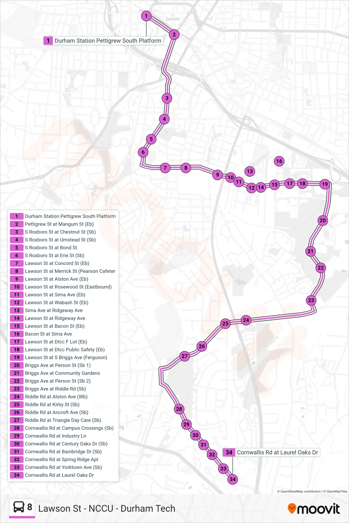
Stops list (8 - 8: Cornwallis Rd)
- Durham Station Pettigrew South Platform
- Pettigrew St at Mangum St (Eb)
- S Roxboro St at Chestnut St (Sb)
- S Roxboro St at Umstead St (Sb)
- S Roxboro St at Bond St
- S Roxboro St at Erie St (Sb)
- Lawson St at Concord St (Eb)
- Lawson St at Merrick St (Pearson Cafeter
- Lawson St at Alston Ave (Eb)
- Lawson St at Rosewood St (Eastbound)
- Lawson St at Sima Ave (Eb)
- Lawson St at Wabash St (Eb)
- Sima Ave at Ridgeway Ave
- Lawson St at Ridgeway Ave
- Lawson St at Bacon St (Eb)
- Bacon St at Sima Ave
- Lawson St at Dtcc F Lot (Eb)
- Lawson St at Dtcc Public Safety (Eb)
- Lawson St at S Briggs Ave (Ferguson)
- Briggs Ave at Person St (Sb 1)
- Briggs Ave at Community Gardens
- Briggs Ave at Person St (Sb 2)
- Briggs Ave at Riddle Rd (Sb)
- Riddle Rd at Alston Ave (Wb)
- Riddle Rd at Kirby St (Sb)
- Riddle Rd at Ancroft Ave (Sb)
- Riddle Rd at Triangle Day Care (Sb)
- Cornwallis Rd at Campus Crossings (Sb)
- Cornwallis Rd at Industry Ln
- Cornwallis Rd at Century Oaks Dr (Sb)
- Cornwallis Rd at Bainbridge Dr (Sb)
- Cornwallis Rd at Spring Ridge Apt
- Cornwallis Rd at Yorktown Ave (Sb)
- Cornwallis Rd at Laurel Oaks Dr