
8 Bus Route Map
View the 8 route map and see all 8 stops along the route. The map of 8 shows where the bus travels and the location of each stop, making it easy to understand the entire route at a glance.
Explore Aachener Straßenbahn- und Energieversorgungs-AG routes on the map and see where Aachener Straßenbahn- und Energieversorgungs-AG bus services operate. Use the 8 map to find bus stops and see how the 8 connects different areas along its trip.
All 8 stops on the map are displayed in route order, helping you follow the 8 bus from the first stop to the last.
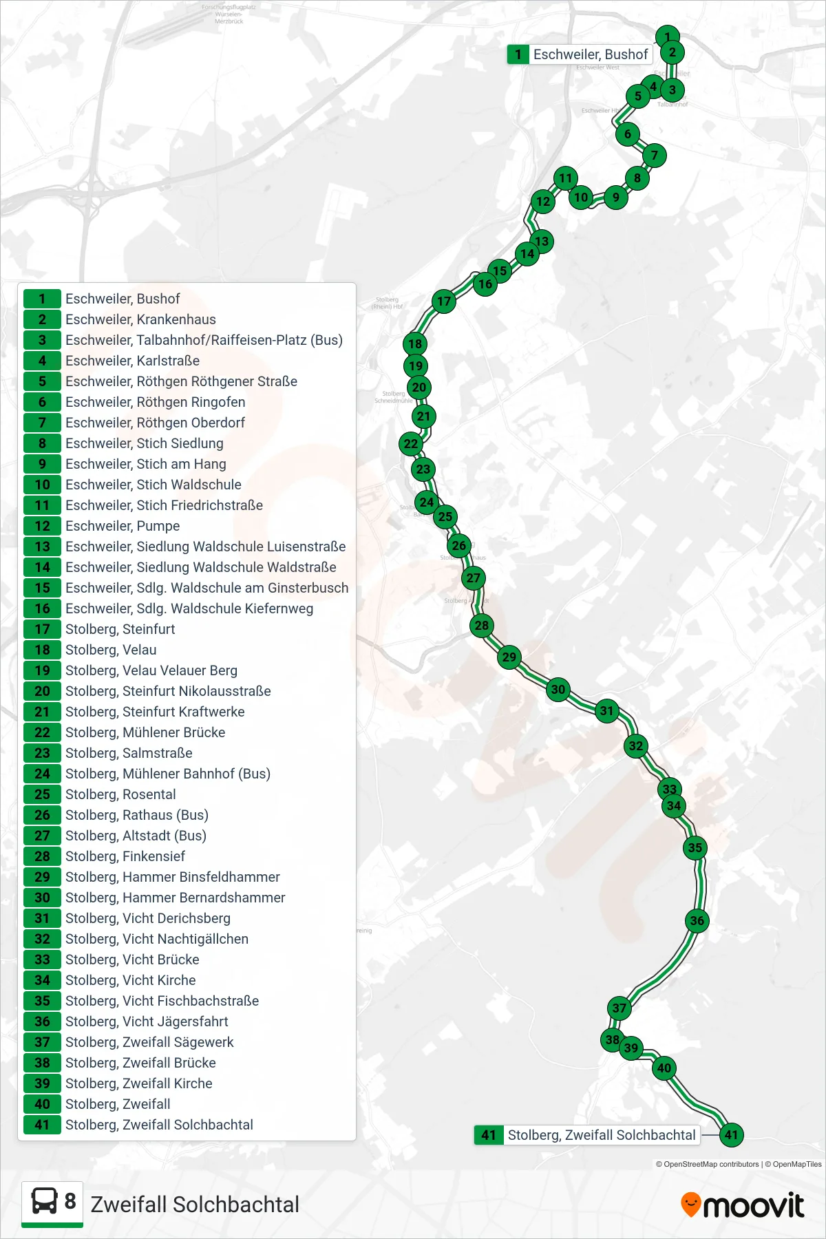
Stops list (8 - Zweifall Solchbachtal)
- Eschweiler, Bushof
- Eschweiler, Krankenhaus
- Eschweiler, Talbahnhof/Raiffeisen-Platz (Bus)
- Eschweiler, Karlstraße
- Eschweiler, Röthgen Röthgener Straße
- Eschweiler, Röthgen Ringofen
- Eschweiler, Röthgen Oberdorf
- Eschweiler, Stich Siedlung
- Eschweiler, Stich am Hang
- Eschweiler, Stich Waldschule
- Eschweiler, Stich Friedrichstraße
- Eschweiler, Pumpe
- Eschweiler, Siedlung Waldschule Luisenstraße
- Eschweiler, Siedlung Waldschule Waldstraße
- Eschweiler, Sdlg. Waldschule am Ginsterbusch
- Eschweiler, Sdlg. Waldschule Kiefernweg
- Stolberg, Steinfurt
- Stolberg, Velau
- Stolberg, Velau Velauer Berg
- Stolberg, Steinfurt Nikolausstraße
- Stolberg, Steinfurt Kraftwerke
- Stolberg, Mühlener Brücke
- Stolberg, Salmstraße
- Stolberg, Mühlener Bahnhof (Bus)
- Stolberg, Rosental
- Stolberg, Rathaus (Bus)
- Stolberg, Altstadt (Bus)
- Stolberg, Finkensief
- Stolberg, Hammer Binsfeldhammer
- Stolberg, Hammer Bernardshammer
- Stolberg, Vicht Derichsberg
- Stolberg, Vicht Nachtigällchen
- Stolberg, Vicht Brücke
- Stolberg, Vicht Kirche
- Stolberg, Vicht Fischbachstraße
- Stolberg, Vicht Jägersfahrt
- Stolberg, Zweifall Sägewerk
- Stolberg, Zweifall Brücke
- Stolberg, Zweifall Kirche
- Stolberg, Zweifall
- Stolberg, Zweifall Solchbachtal