
8 Bus Route Map
View the 8 route map and see all 8 stops along the route. The map of 8 shows where the bus travels and the location of each stop, making it easy to understand the entire route at a glance.
Explore Francigena routes on the map and see where Francigena bus services operate. Use the 8 map to find bus stops and see how the 8 connects different areas along its trip.
All 8 stops on the map are displayed in route order, helping you follow the 8 bus from the first stop to the last.
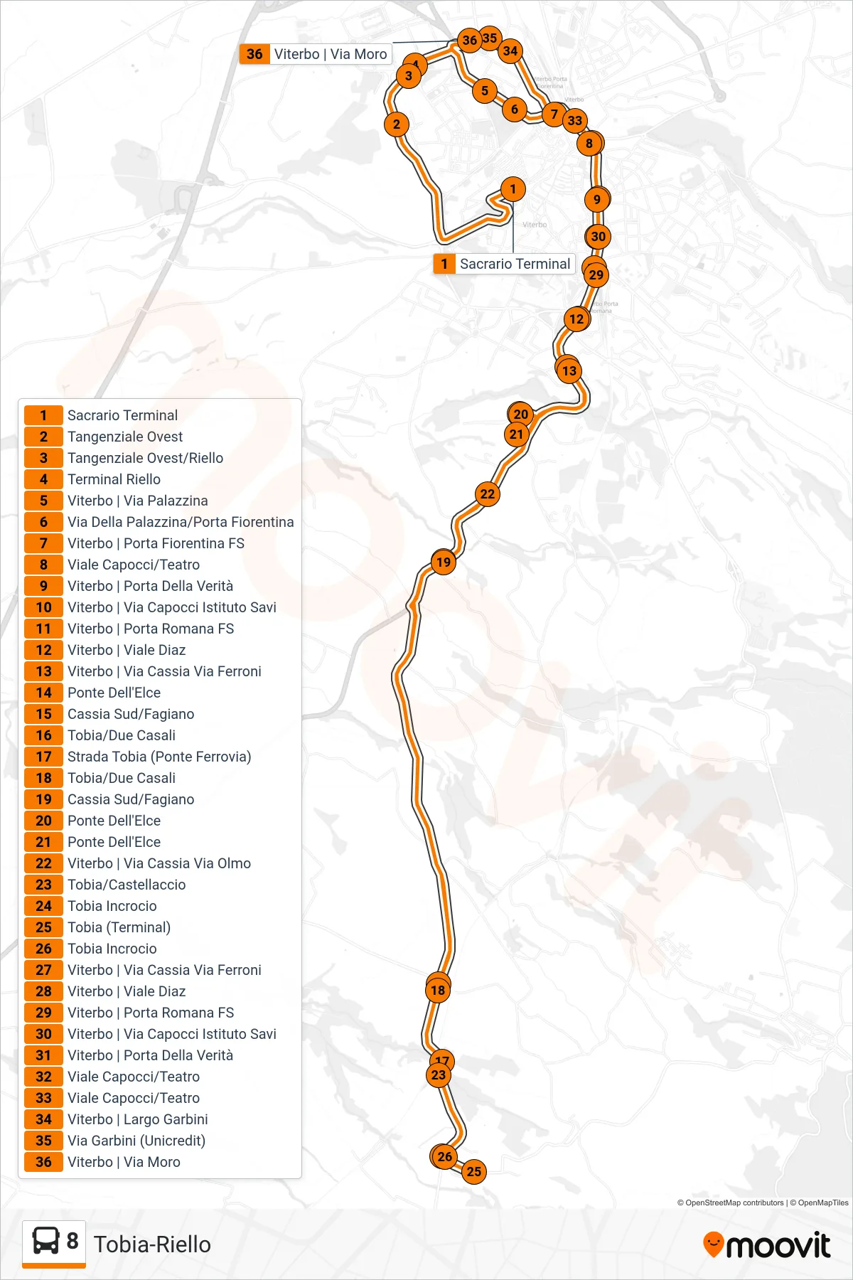
Stops list (8 - Tobia-Riello)
- Memorial Terminal
- West Ring Road
- Western Ring Road/Riello
- Riello Terminal
- Viterbo | Via Palazzina
- Palazzina Street/Florentine Gate
- Viterbo | Porta Fiorentina Station
- Capocci Avenue/Theater
- Viterbo | Gate of Truth
- Viterbo | Capocci Street Savi Institute
- Viterbo | Porta Romana Station
- Viterbo | Diaz Avenue
- Viterbo | Cassia Street Via Ferroni
- Ponte Dell'Elce
- South Cassia/Fagiano
- Tobia/Due Casali
- Tobia Road (Railway Bridge)
- Tobia/Due Casali
- South Cassia/Fagiano
- Ponte Dell'Elce
- Ponte Dell'Elce
- Viterbo - Via Cassia Via Olmo
- Tobia/Castellaccio
- Tobia Intersection
- Tobia (Terminal)
- Tobia Intersection
- Viterbo | Cassia Street Via Ferroni
- Viterbo | Diaz Avenue
- Viterbo | Porta Romana Station
- Viterbo | Capocci Street Savi Institute
- Viterbo | Gate of Truth
- Capocci Avenue/Theater
- Capocci Avenue/Theater
- Viterbo - Garbini Square
- Garbini Street (Unicredit)
- Viterbo | Moro Street