
8 Bus Route Map
View the 8 route map and see all 8 stops along the route. The map of 8 shows where the bus travels and the location of each stop, making it easy to understand the entire route at a glance.
Explore SMTD routes on the map and see where SMTD bus services operate. Use the 8 map to find bus stops and see how the 8 connects different areas along its trip.
All 8 stops on the map are displayed in route order, helping you follow the 8 bus from the first stop to the last.
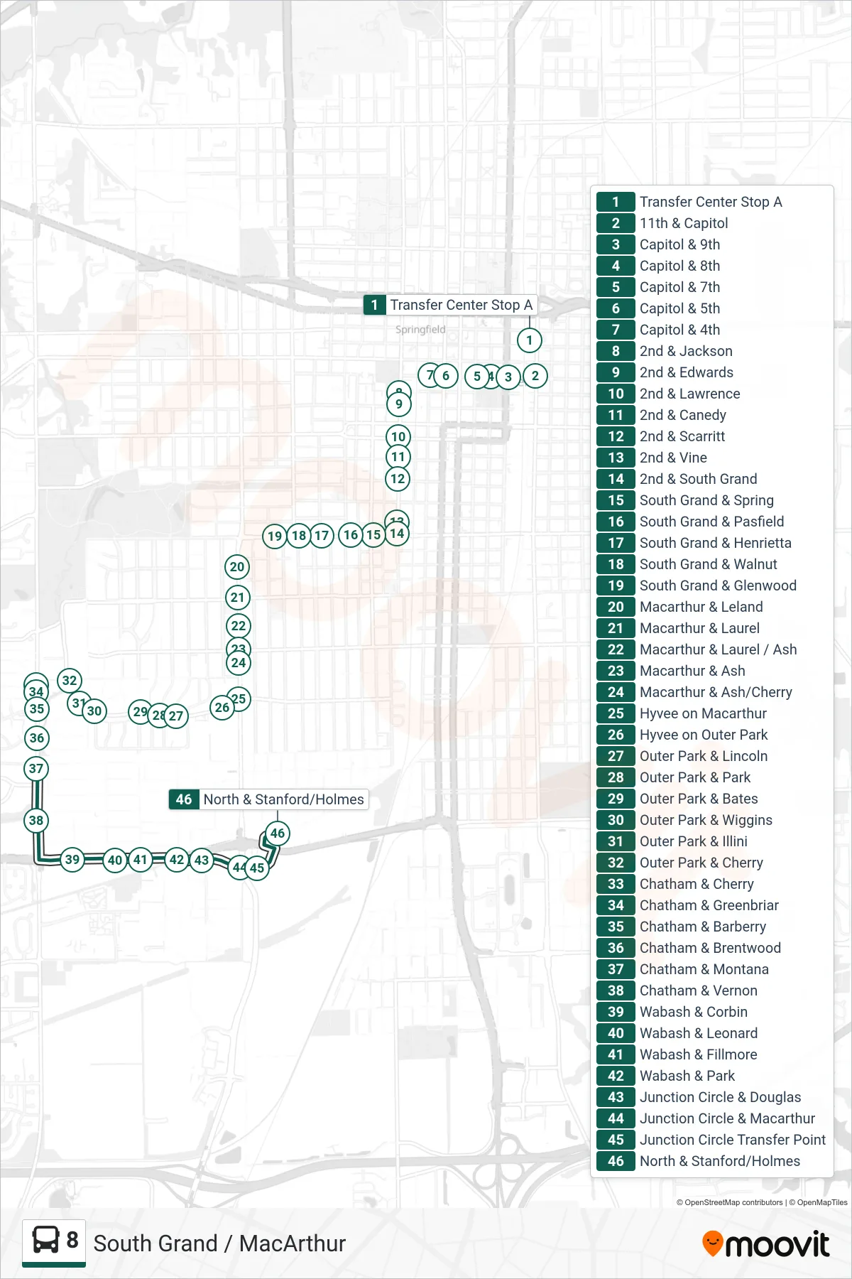
Stops list (8 - 8 South Grand Macarthur North Street)
- Transfer Center Stop A
- 11th & Capitol
- Capitol & 9th
- Capitol & 8th
- Capitol & 7th
- Capitol & 5th
- Capitol & 4th
- 2nd & Jackson
- 2nd & Edwards
- 2nd & Lawrence
- 2nd & Canedy
- 2nd & Scarritt
- 2nd & Vine
- 2nd & South Grand
- South Grand & Spring
- South Grand & Pasfield
- South Grand & Henrietta
- South Grand & Walnut
- South Grand & Glenwood
- Macarthur & Leland
- Macarthur & Laurel
- Macarthur & Laurel / Ash
- Macarthur & Ash
- Macarthur & Ash/Cherry
- Hyvee on Macarthur
- Hyvee on Outer Park
- Outer Park & Lincoln
- Outer Park & Park
- Outer Park & Bates
- Outer Park & Wiggins
- Outer Park & Illini
- Outer Park & Cherry
- Chatham & Cherry
- Chatham & Greenbriar
- Chatham & Barberry
- Chatham & Brentwood
- Chatham & Montana
- Chatham & Vernon
- Wabash & Corbin
- Wabash & Leonard
- Wabash & Fillmore
- Wabash & Park
- Junction Circle & Douglas
- Junction Circle & Macarthur
- Junction Circle Transfer Point
- North & Stanford/Holmes