
80 Bus Route Map
View the 80 route map and see all 80 stops along the route. The map of 80 shows where the bus travels and the location of each stop, making it easy to understand the entire route at a glance.
Explore Bus Átha Cliath – Dublin Bus routes on the map and see where Bus Átha Cliath – Dublin Bus bus services operate. Use the 80 map to find bus stops and see how the 80 connects different areas along its trip.
All 80 stops on the map are displayed in route order, helping you follow the 80 bus from the first stop to the last.
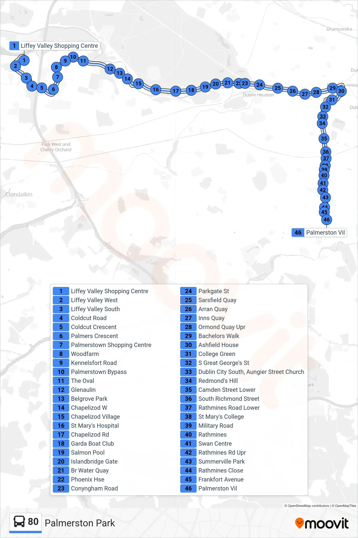

Stops list (80 - Palmerston Park)
- Liffey Valley Shopping Centre
- Liffey Valley West
- Liffey Valley South
- Coldcut Road
- Coldcut Crescent
- Palmers Crescent
- Palmerstown Shopping Centre
- Woodfarm
- Kennelsfort Road
- Palmerstown Bypass
- The Oval
- Glenaulin
- Belgrove Park
- Chapelizod W
- Chapelizod Village
- St Mary's Hospital
- Chapelizod Rd
- Garda Boat Club
- Salmon Pool
- Islandbridge Gate
- Br Water Quay
- Phoenix Hse
- Conyngham Road
- Parkgate St
- Sarsfield Quay
- Arran Quay
- Inns Quay
- Ormond Quay Upr
- Bachelors Walk
- Ashfield House
- College Green
- S Great George's St
- Dublin City South, Aungier Street Church
- Redmond's Hill
- Camden Street Lower
- South Richmond Street
- Rathmines Road Lower
- St Mary's College
- Military Road
- Rathmines
- Swan Centre
- Rathmines Rd Upr
- Summerville Park
- Rathmines Close
- Frankfort Avenue
- Palmerston Vil