
80 Bus Route Map
View the 80 route map and see all 80 stops along the route. The map of 80 shows where the bus travels and the location of each stop, making it easy to understand the entire route at a glance.
Explore Josephine Community Transit routes on the map and see where Josephine Community Transit bus services operate. Use the 80 map to find bus stops and see how the 80 connects different areas along its trip.
All 80 stops on the map are displayed in route order, helping you follow the 80 bus from the first stop to the last.
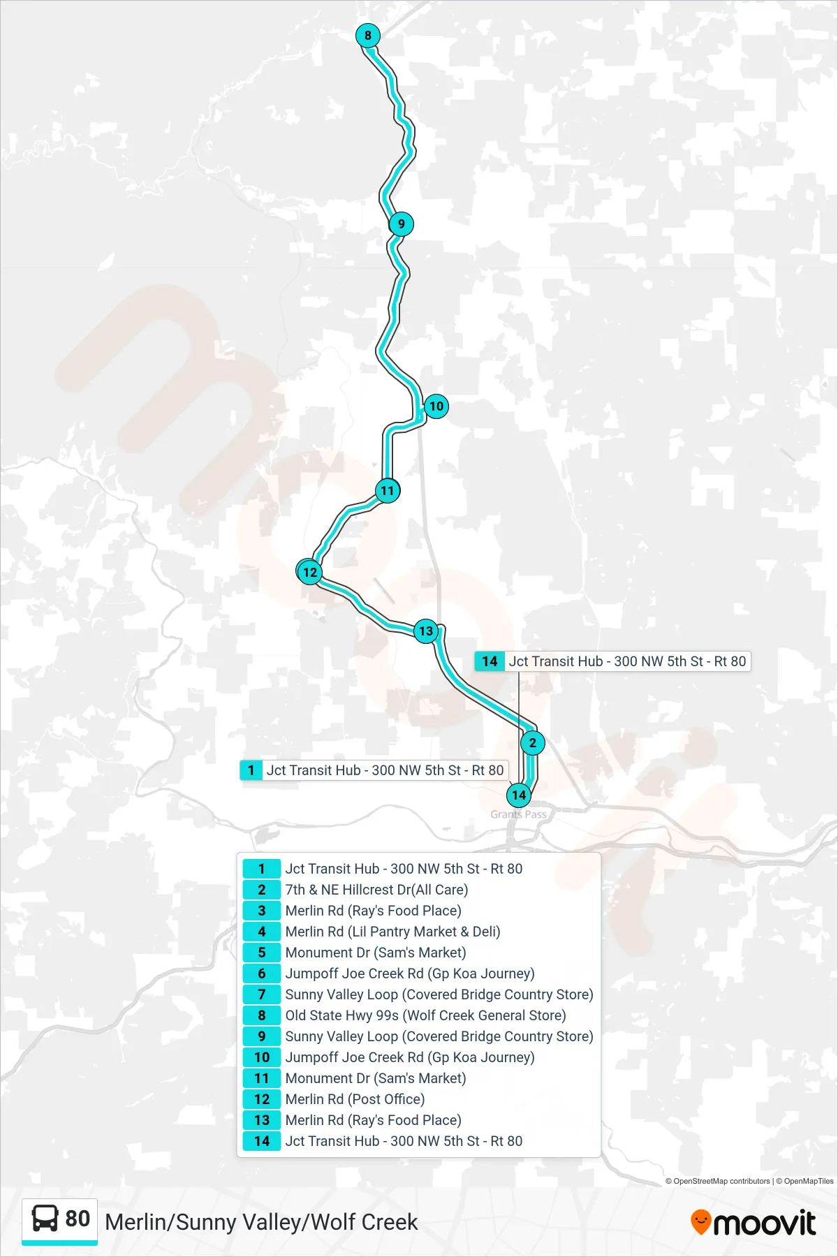
Stops list (80 - Merlin/Sunny Valley/Wolf Creek)
- Jct Transit Hub - 300 NW 5th St - Rt 80
- 7th & NE Hillcrest Dr(All Care)
- Merlin Rd (Ray's Food Place)
- Merlin Rd (Lil Pantry Market & Deli)
- Monument Dr (Sam's Market)
- Jumpoff Joe Creek Rd (Gp Koa Journey)
- Sunny Valley Loop (Covered Bridge Country Store)
- Old State Hwy 99s (Wolf Creek General Store)
- Sunny Valley Loop (Covered Bridge Country Store)
- Jumpoff Joe Creek Rd (Gp Koa Journey)
- Monument Dr (Sam's Market)
- Merlin Rd (Post Office)
- Merlin Rd (Ray's Food Place)
- Jct Transit Hub - 300 NW 5th St - Rt 80