
800 Bus Route Map
View the 800 route map and see all 800 stops along the route. The map of 800 shows where the bus travels and the location of each stop, making it easy to understand the entire route at a glance.
Explore VBB routes on the map and see where VBB bus services operate. Use the 800 map to find bus stops and see how the 800 connects different areas along its trip.
All 800 stops on the map are displayed in route order, helping you follow the 800 bus from the first stop to the last.
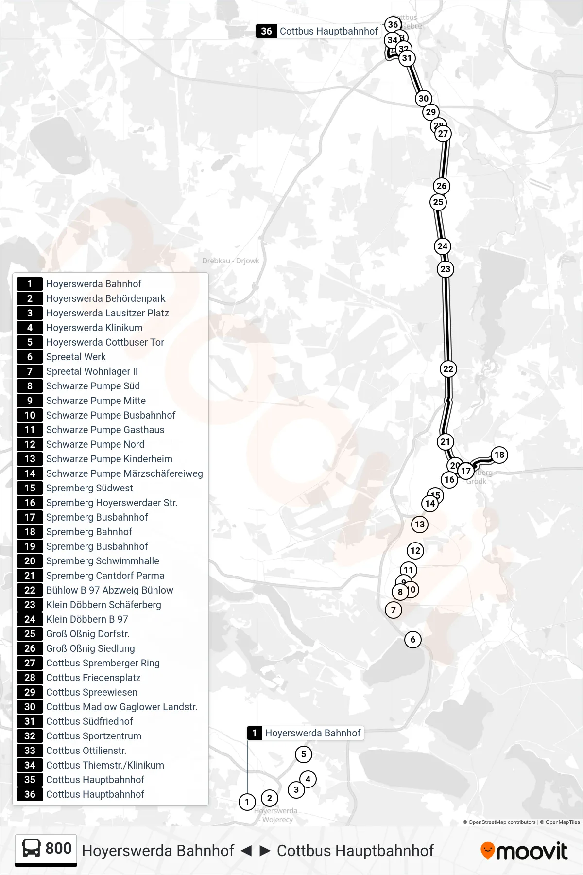
Stops list (800 - Cottbus Hauptbahnhof)
- Hoyerswerda Bahnhof
- Hoyerswerda Behördenpark
- Hoyerswerda Lausitzer Platz
- Hoyerswerda Klinikum
- Hoyerswerda Cottbuser Tor
- Spreetal Werk
- Spreetal Wohnlager II
- Schwarze Pumpe Süd
- Schwarze Pumpe Mitte
- Schwarze Pumpe Busbahnhof
- Schwarze Pumpe Gasthaus
- Schwarze Pumpe Nord
- Schwarze Pumpe Kinderheim
- Schwarze Pumpe Märzschäfereiweg
- Spremberg Südwest
- Spremberg Hoyerswerdaer Str.
- Spremberg Busbahnhof
- Spremberg Bahnhof
- Spremberg Busbahnhof
- Spremberg Schwimmhalle
- Spremberg Cantdorf Parma
- Bühlow B 97 Abzweig Bühlow
- Klein Döbbern Schäferberg
- Klein Döbbern B 97
- Groß Oßnig Dorfstr.
- Groß Oßnig Siedlung
- Cottbus Spremberger Ring
- Cottbus Friedensplatz
- Cottbus Spreewiesen
- Cottbus Madlow Gaglower Landstr.
- Cottbus Südfriedhof
- Cottbus Sportzentrum
- Cottbus Ottilienstr.
- Cottbus Thiemstr./Klinikum
- Cottbus Hauptbahnhof
- Cottbus Hauptbahnhof