
804 Bus Route Map
View the 804 route map and see all 804 stops along the route. The map of 804 shows where the bus travels and the location of each stop, making it easy to understand the entire route at a glance.
Explore Oberhavel Verkehrsgesellschaft routes on the map and see where Oberhavel Verkehrsgesellschaft bus services operate. Use the 804 map to find bus stops and see how the 804 connects different areas along its trip.
All 804 stops on the map are displayed in route order, helping you follow the 804 bus from the first stop to the last.
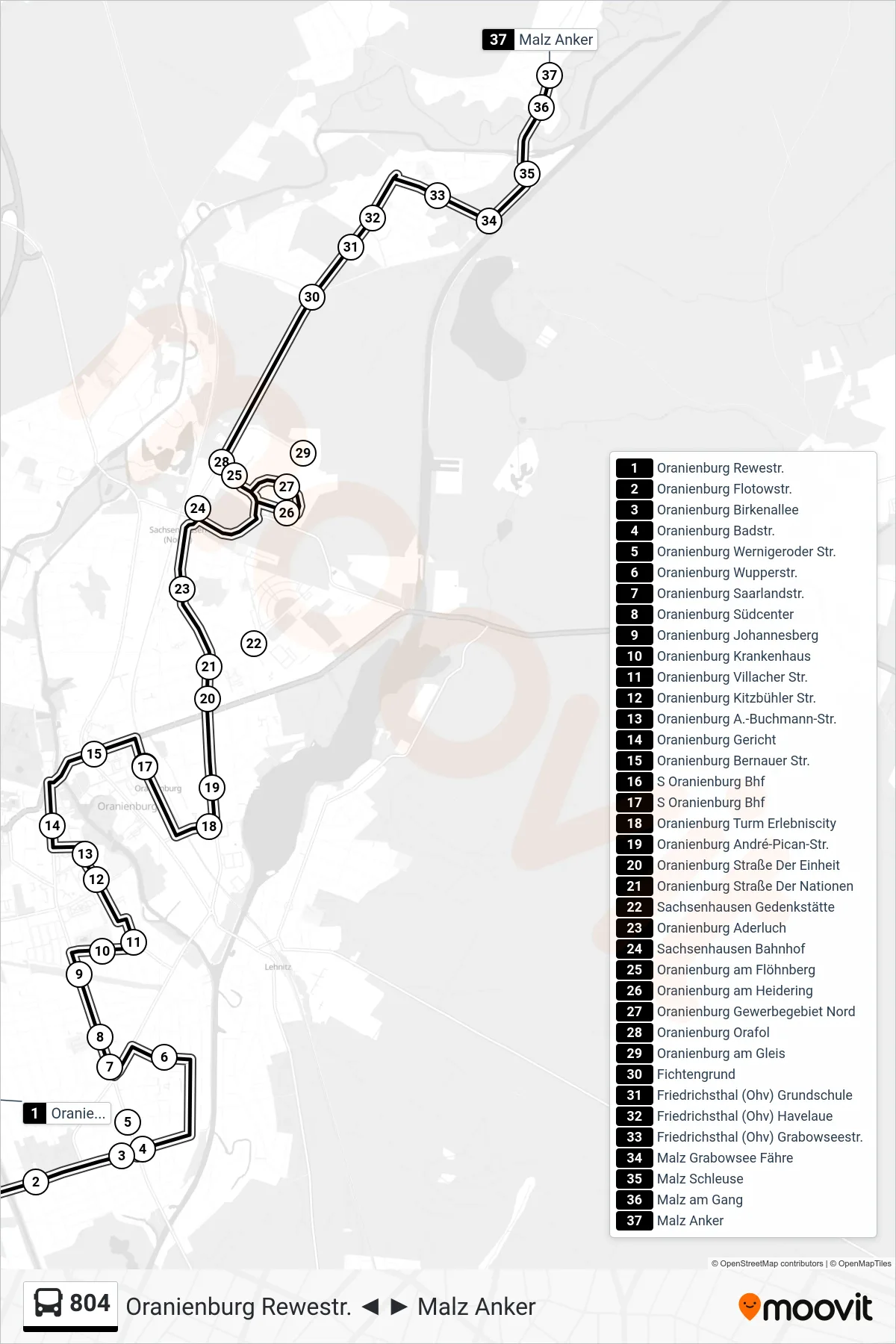
Stops list (804 - Malz Anker)
- Oranienburg Rewestr.
- Oranienburg Flotowstr.
- Oranienburg Birkenallee
- Oranienburg Badstr.
- Oranienburg Wernigeroder Str.
- Oranienburg Wupperstr.
- Oranienburg Saarlandstr.
- Oranienburg Südcenter
- Oranienburg Johannesberg
- Oranienburg Krankenhaus
- Oranienburg Villacher Str.
- Oranienburg Kitzbühler Str.
- Oranienburg A.-Buchmann-Str.
- Oranienburg Gericht
- Oranienburg Bernauer Str.
- S Oranienburg Bhf
- S Oranienburg Bhf
- Oranienburg Turm Erlebniscity
- Oranienburg André-Pican-Str.
- Oranienburg Straße Der Einheit
- Oranienburg Straße Der Nationen
- Sachsenhausen Gedenkstätte
- Oranienburg Aderluch
- Sachsenhausen Bahnhof
- Oranienburg am Flöhnberg
- Oranienburg am Heidering
- Oranienburg Gewerbegebiet Nord
- Oranienburg Orafol
- Oranienburg am Gleis
- Fichtengrund
- Friedrichsthal (Ohv) Grundschule
- Friedrichsthal (Ohv) Havelaue
- Friedrichsthal (Ohv) Grabowseestr.
- Malz Grabowsee Fähre
- Malz Schleuse
- Malz am Gang
- Malz Anker