
81 Bus Route Map
View the 81 route map and see all 81 stops along the route. The map of 81 shows where the bus travels and the location of each stop, making it easy to understand the entire route at a glance.
Explore Montgomery County Ride On routes on the map and see where Montgomery County Ride On bus services operate. Use the 81 map to find bus stops and see how the 81 connects different areas along its trip.
All 81 stops on the map are displayed in route order, helping you follow the 81 bus from the first stop to the last.
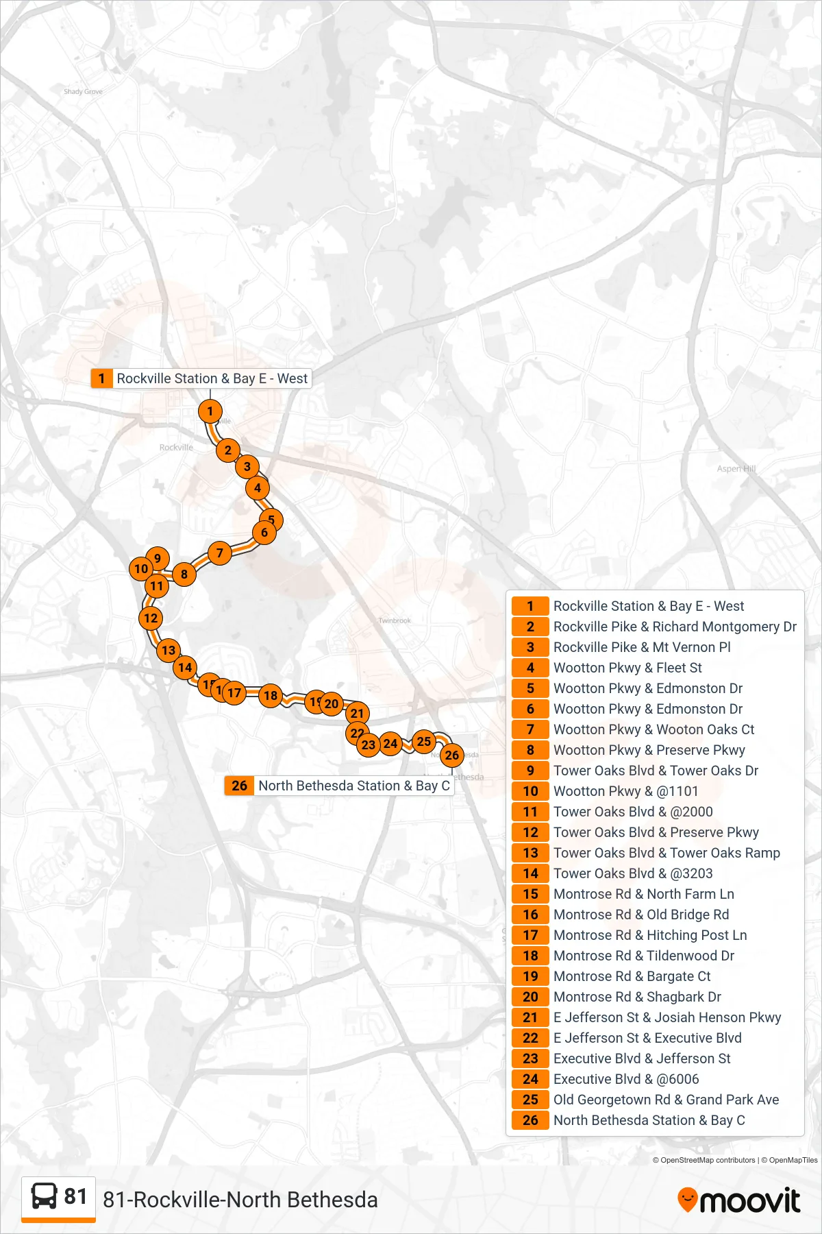
Stops list (81 - North Bethesda)
- Rockville Station & Bay E - West
- Rockville Pike & Richard Montgomery Dr
- Rockville Pike & Mt Vernon Pl
- Wootton Pkwy & Fleet St
- Wootton Pkwy & Edmonston Dr
- Wootton Pkwy & Edmonston Dr
- Wootton Pkwy & Wooton Oaks Ct
- Wootton Pkwy & Preserve Pkwy
- Tower Oaks Blvd & Tower Oaks Dr
- Wootton Pkwy & @1101
- Tower Oaks Blvd & @2000
- Tower Oaks Blvd & Preserve Pkwy
- Tower Oaks Blvd & Tower Oaks Ramp
- Tower Oaks Blvd & @3203
- Montrose Rd & North Farm Ln
- Montrose Rd & Old Bridge Rd
- Montrose Rd & Hitching Post Ln
- Montrose Rd & Tildenwood Dr
- Montrose Rd & Bargate Ct
- Montrose Rd & Shagbark Dr
- E Jefferson St & Josiah Henson Pkwy
- E Jefferson St & Executive Blvd
- Executive Blvd & Jefferson St
- Executive Blvd & @6006
- Old Georgetown Rd & Grand Park Ave
- North Bethesda Station & Bay C