
830 Bus Route Map
View the 830 route map and see all 830 stops along the route. The map of 830 shows where the bus travels and the location of each stop, making it easy to understand the entire route at a glance.
Explore Landbus Bregenzerwald routes on the map and see where Landbus Bregenzerwald bus services operate. Use the 830 map to find bus stops and see how the 830 connects different areas along its trip.
All 830 stops on the map are displayed in route order, helping you follow the 830 bus from the first stop to the last.
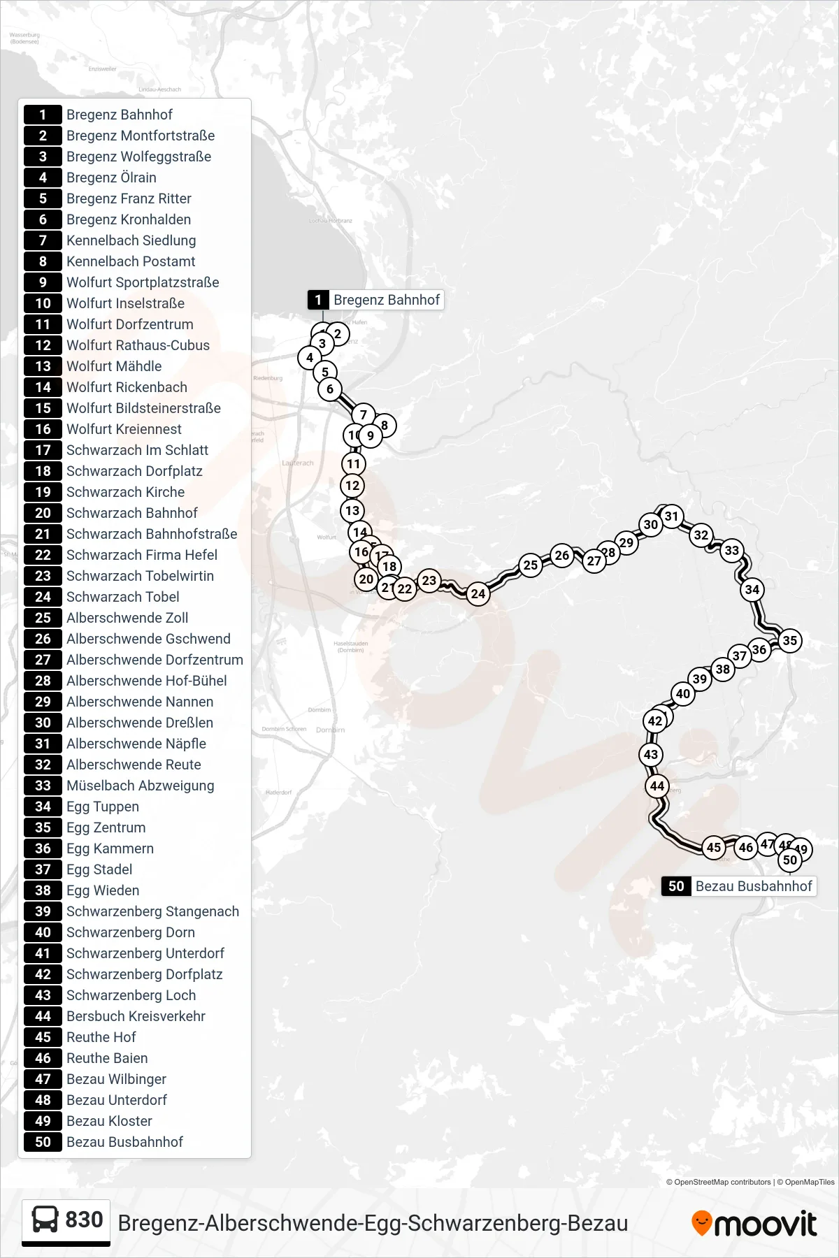
Stops list (830 - Bezau Busbahnhof)
- Bregenz Bahnhof
- Bregenz Montfortstraße
- Bregenz Wolfeggstraße
- Bregenz Ölrain
- Bregenz Franz Ritter
- Bregenz Kronhalden
- Kennelbach Siedlung
- Kennelbach Postamt
- Wolfurt Sportplatzstraße
- Wolfurt Inselstraße
- Wolfurt Dorfzentrum
- Wolfurt Rathaus-Cubus
- Wolfurt Mähdle
- Wolfurt Rickenbach
- Wolfurt Bildsteinerstraße
- Wolfurt Kreiennest
- Schwarzach Im Schlatt
- Schwarzach Dorfplatz
- Schwarzach Kirche
- Schwarzach Bahnhof
- Schwarzach Bahnhofstraße
- Schwarzach Firma Hefel
- Schwarzach Tobelwirtin
- Schwarzach Tobel
- Alberschwende Zoll
- Alberschwende Gschwend
- Alberschwende Dorfzentrum
- Alberschwende Hof-Bühel
- Alberschwende Nannen
- Alberschwende Dreßlen
- Alberschwende Näpfle
- Alberschwende Reute
- Müselbach Abzweigung
- Egg Tuppen
- Egg Zentrum
- Egg Kammern
- Egg Stadel
- Egg Wieden
- Schwarzenberg Stangenach
- Schwarzenberg Dorn
- Schwarzenberg Unterdorf
- Schwarzenberg Dorfplatz
- Schwarzenberg Loch
- Bersbuch Kreisverkehr
- Reuthe Hof
- Reuthe Baien
- Bezau Wilbinger
- Bezau Unterdorf
- Bezau Kloster
- Bezau Busbahnhof