
84 Bus Route Map
View the 84 route map and see all 84 stops along the route. The map of 84 shows where the bus travels and the location of each stop, making it easy to understand the entire route at a glance.
Explore Autobuses routes on the map and see where Autobuses bus services operate. Use the 84 map to find bus stops and see how the 84 connects different areas along its trip.
All 84 stops on the map are displayed in route order, helping you follow the 84 bus from the first stop to the last.
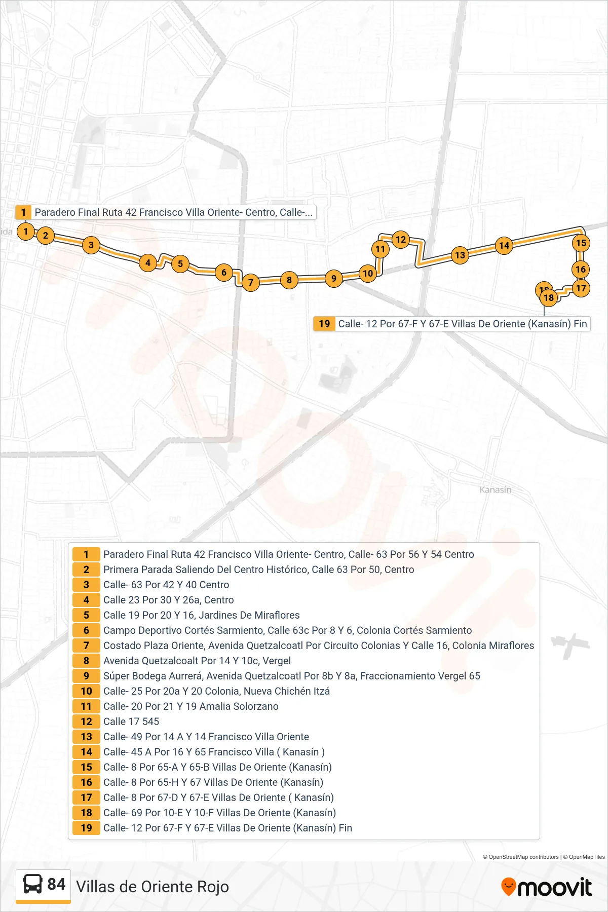
Stops list (84 - Amalia Villas Oriente Rojo)
- Paradero Final Ruta 42 Francisco Villa Oriente- Centro, Calle- 63 Por 56 Y 54 Centro
- Primera Parada Saliendo Del Centro Histórico, Calle 63 Por 50, Centro
- Calle- 63 Por 42 Y 40 Centro
- Calle 23 Por 30 Y 26a, Centro
- Calle 19 Por 20 Y 16, Jardines De Miraflores
- Campo Deportivo Cortés Sarmiento, Calle 63c Por 8 Y 6, Colonia Cortés Sarmiento
- Costado Plaza Oriente, Avenida Quetzalcoatl Por Circuito Colonias Y Calle 16, Colonia Miraflores
- Avenida Quetzalcoalt Por 14 Y 10c, Vergel
- Súper Bodega Aurrerá, Avenida Quetzalcoatl Por 8b Y 8a, Fraccionamiento Vergel 65
- Calle- 25 Por 20a Y 20 Colonia, Nueva Chichén Itzá
- Calle- 20 Por 21 Y 19 Amalia Solorzano
- Calle 17 545
- Calle- 49 Por 14 A Y 14 Francisco Villa Oriente
- Calle- 45 A Por 16 Y 65 Francisco Villa ( Kanasín )
- Calle- 8 Por 65-A Y 65-B Villas De Oriente (Kanasín)
- Calle- 8 Por 65-H Y 67 Villas De Oriente (Kanasín)
- Calle- 8 Por 67-D Y 67-E Villas De Oriente ( Kanasín)
- Calle- 69 Por 10-E Y 10-F Villas De Oriente (Kanasín)
- Calle- 12 Por 67-F Y 67-E Villas De Oriente (Kanasín) Fin