
84 Bus Route Map
View the 84 route map and see all 84 stops along the route. The map of 84 shows where the bus travels and the location of each stop, making it easy to understand the entire route at a glance.
Explore Niederrheinische VKB routes on the map and see where Niederrheinische VKB bus services operate. Use the 84 map to find bus stops and see how the 84 connects different areas along its trip.
All 84 stops on the map are displayed in route order, helping you follow the 84 bus from the first stop to the last.
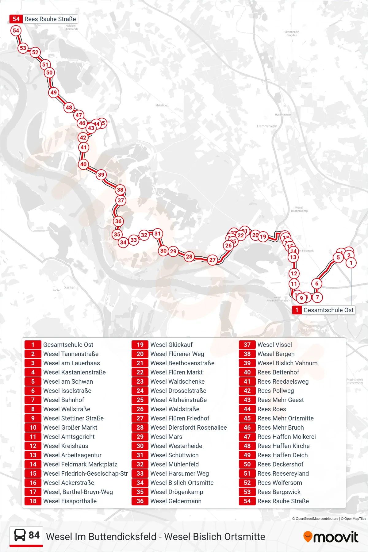
Stops list (84 - Rees Rauhe Straße)
- Gesamtschule Ost
- Wesel Tannenstraße
- Wesel am Lauerhaas
- Wesel Kastanienstraße
- Wesel am Schwan
- Wesel Isselstraße
- Wesel Bahnhof
- Wesel Wallstraße
- Wesel Stettiner Straße
- Wesel Großer Markt
- Wesel Amtsgericht
- Wesel Kreishaus
- Wesel Arbeitsagentur
- Wesel Feldmark Marktplatz
- Wesel Friedrich-Geselschap-Str
- Wesel Ackerstraße
- Wesel, Barthel-Bruyn-Weg
- Wesel Eissporthalle
- Wesel Glückauf
- Wesel Flürener Weg
- Wesel Beethovenstraße
- Wesel Flüren Markt
- Wesel Waldschenke
- Wesel Drosselstraße
- Wesel Altrheinstraße
- Wesel Waldstraße
- Wesel Flüren Friedhof
- Wesel Diersfordt Rosenallee
- Wesel Mars
- Wesel Westerheide
- Wesel Schüttwich
- Wesel Mühlenfeld
- Wesel Harsumer Weg
- Wesel Bislich Ortsmitte
- Wesel Drögenkamp
- Wesel Geldermann
- Wesel Vissel
- Wesel Bergen
- Wesel Bislich Vahnum
- Rees Bettenhof
- Rees Reedaelsweg
- Rees Pollweg
- Rees Mehr Geest
- Rees Roes
- Rees Mehr Ortsmitte
- Rees Mehr Bruch
- Rees Haffen Molkerei
- Rees Haffen Kirche
- Rees Haffen Deich
- Rees Deckershof
- Rees Reesereyland
- Rees Wolfersom
- Rees Bergswick
- Rees Rauhe Straße