
850 Bus Route Map
View the 850 route map and see all 850 stops along the route. The map of 850 shows where the bus travels and the location of each stop, making it easy to understand the entire route at a glance.
Explore NeUBus routes on the map and see where NeUBus bus services operate. Use the 850 map to find bus stops and see how the 850 connects different areas along its trip.
All 850 stops on the map are displayed in route order, helping you follow the 850 bus from the first stop to the last.
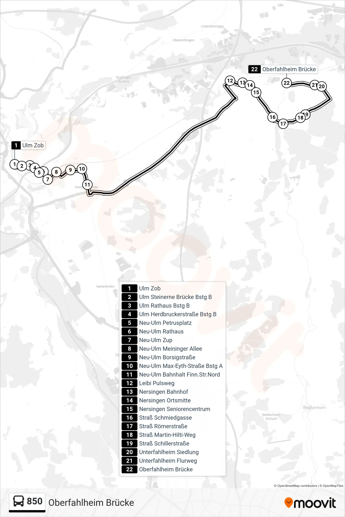
Stops list (850 - Oberfahlheim Brücke)
- Ulm Zob
- Ulm Steinerne Brücke Bstg B
- Ulm Rathaus Bstg B
- Ulm Herdbruckerstraße Bstg B
- Neu-Ulm Petrusplatz
- Neu-Ulm Rathaus
- Neu-Ulm Zup
- Neu-Ulm Meininger Allee
- Neu-Ulm Borsigstraße
- Neu-Ulm Max-Eyth-Straße Bstg A
- Neu-Ulm Bahnhalt Finn.Str.Nord
- Leibi Pulsweg
- Nersingen Bahnhof
- Nersingen Ortsmitte
- Nersingen Seniorencentrum
- Straß Schmiedgasse
- Straß Römerstraße
- Straß Martin-Hilti-Weg
- Straß Schillerstraße
- Unterfahlheim Siedlung
- Unterfahlheim Flurweg
- Oberfahlheim Brücke
Change direction
- Route Map - 850 - Echlishausen, Siedlung
- Route Map - 850 - Günzburg, am Stadtbach
- Route Map - 850 - Günzburg
- Route Map - 850 - Neu-Ulm Otto-Hahn-Straße/Süd
- Route Map - 850 - Günzburg, Krankenhausstr.
- Route Map - 850 - Leibi Pulsweg
- Route Map - 850 - Leipheim, Schloßhaldensiedlung
- Route Map - 850 - Nersingen West
- Route Map - 850 - Ulm Zob
- Route Map - 850 - Neu-Ulm Zup
- Route Map - 850 - Straß Römerstraße