
89 Bus Route Map
View the 89 route map and see all 89 stops along the route. The map of 89 shows where the bus travels and the location of each stop, making it easy to understand the entire route at a glance.
Explore Electra Afikim routes on the map and see where Electra Afikim bus services operate. Use the 89 map to find bus stops and see how the 89 connects different areas along its trip.
All 89 stops on the map are displayed in route order, helping you follow the 89 bus from the first stop to the last.
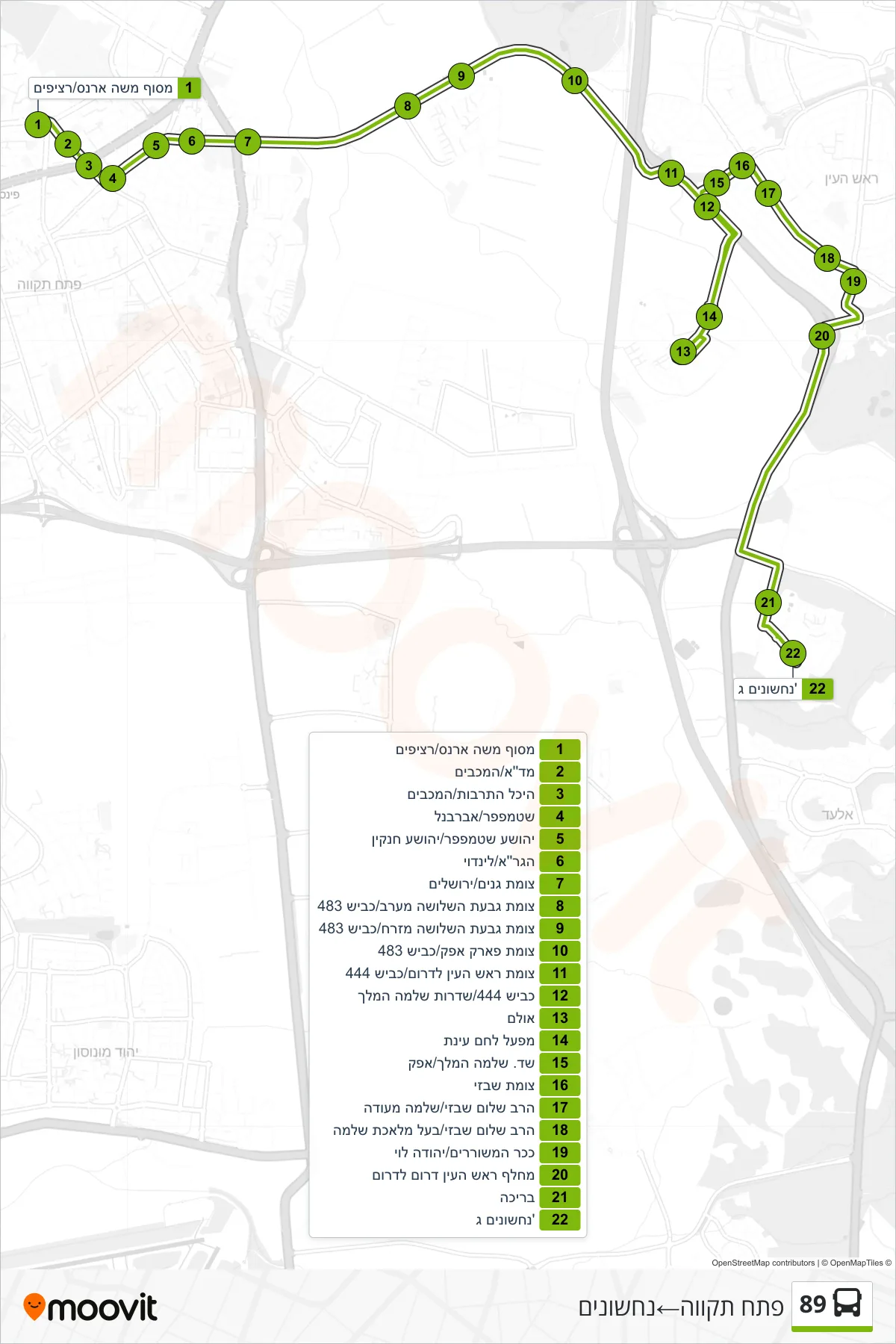
Stops list (89 - Petah Tikva→Nachshonim)
- Moshe Arens Terminal/Platforms
- MDA/HaMaccabim
- Culture Hall/HaMaccabim
- Stampfer/Abarbanel
- Yehoshua Stampfer/Yehoshua Hankin
- HaGra/Lindoy
- Ganim Junction/Jerusalem
- West Givat HaShlosha Junction/Road 483
- Givat HaShlosha East Junction/Road 483
- Afek Park Junction/Road 483
- Rosh HaAyin South Junction/Road 444
- Road 444/King Solomon Boulevard
- Hall
- Einat Bread Factory
- King Solomon Boulevard/Afek
- Shabazi Junction
- Rabbi Shalom Shabazi/Shlomo Meoda
- Rabbi Shalom Shabazi/Baal Melechet Shlomo
- Poets Square/Yehuda Levi
- Rosh HaAyin South Interchange South
- Pool
- Nachshonim C