
8BUS Bus Route Map
View the 8BUS route map and see all 8BUS stops along the route. The map of 8BUS shows where the bus travels and the location of each stop, making it easy to understand the entire route at a glance.
Explore ATAC routes on the map and see where ATAC bus services operate. Use the 8BUS map to find bus stops and see how the 8BUS connects different areas along its trip.
All 8BUS stops on the map are displayed in route order, helping you follow the 8BUS bus from the first stop to the last.
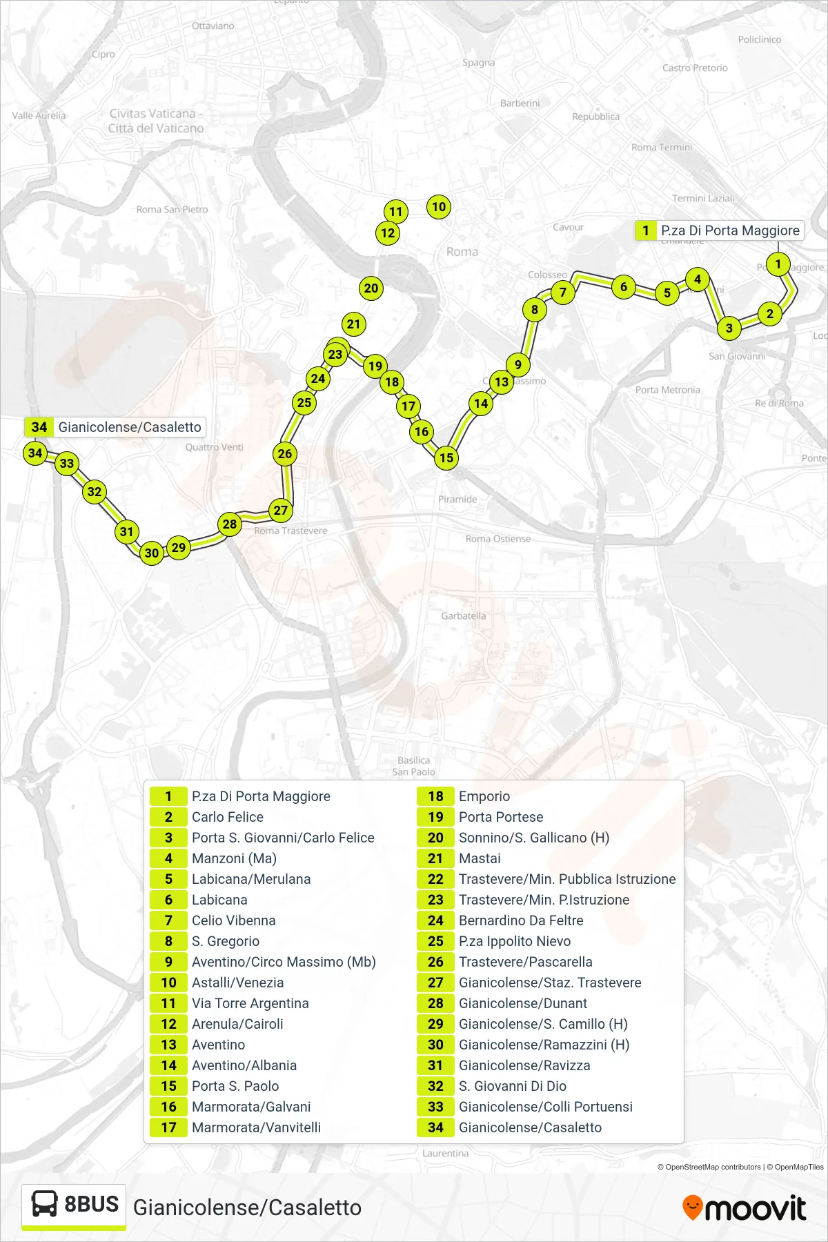
Stops list (8BUS - Gianicolense/Casaletto)
- Piazza Di Porta Maggiore
- Carlo Felice
- Porta San Giovanni/Carlo Felice
- Manzoni
- Labicana/Merulana
- Labicana
- Celio Vibenna
- St. Gregory
- Aventine/Circus Maximus (Metro)
- Astalli/Venezia
- Torre Argentina Street
- Arenula/Cairoli
- Aventino
- Aventino/Albania
- St. Paul's Gate
- Marmorata/Galvani
- Marmorata/Vanvitelli
- Emporio
- Porta Portese
- Sonnino/San Gallicano (Hospital)
- Mastai
- Trastevere/Ministry of Public Education
- Trastevere/Ministry of Education
- Bernardino Da Feltre
- Ippolito Nievo Square
- Trastevere/Pascarella
- Gianicolense/Trastevere Station
- Gianicolense/Dunant
- Gianicolense/S. Camillo Hospital
- Gianicolense/Ramazzini (H)
- Gianicolense/Ravizza
- St. John of God
- Gianicolense/Colli Portuensi
- Gianicolense/Casaletto