
9 Bus Route Map
View the 9 route map and see all 9 stops along the route. The map of 9 shows where the bus travels and the location of each stop, making it easy to understand the entire route at a glance.
Explore Transport Board routes on the map and see where Transport Board bus services operate. Use the 9 map to find bus stops and see how the 9 connects different areas along its trip.
All 9 stops on the map are displayed in route order, helping you follow the 9 bus from the first stop to the last.
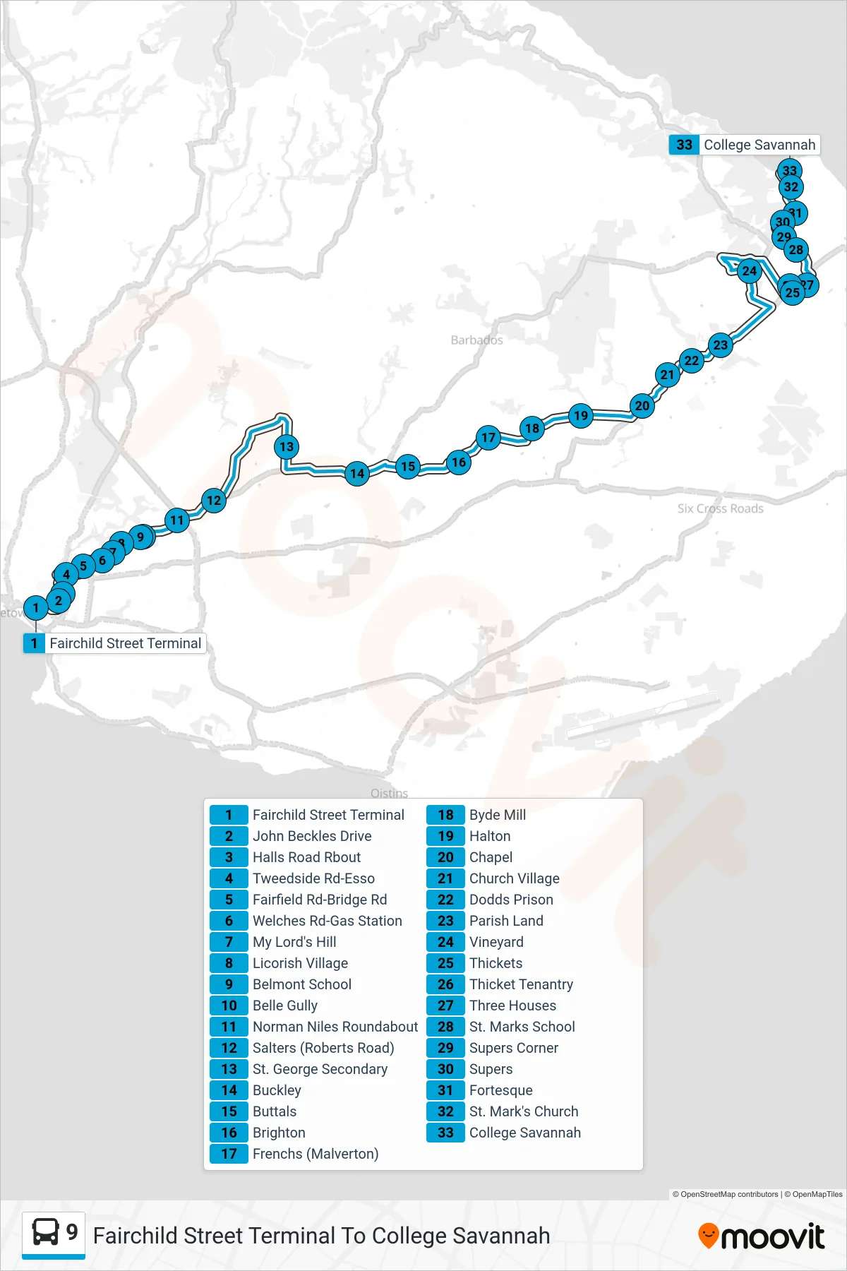
Stops list (9 - Fairchild Street Terminal To College Savannah)
- Fairchild Street Terminal
- John Beckles Drive
- Halls Road Rbout
- Tweedside Rd-Esso
- Fairfield Rd-Bridge Rd
- Welches Rd-Gas Station
- My Lord's Hill
- Licorish Village
- Belmont School
- Belle Gully
- Norman Niles Roundabout
- Salters (Roberts Road)
- St. George Secondary
- Buckley
- Buttals
- Brighton
- Frenchs (Malverton)
- Byde Mill
- Halton
- Chapel
- Church Village
- Dodds Prison
- Parish Land
- Vineyard
- Thickets
- Thicket Tenantry
- Three Houses
- St. Marks School
- Supers Corner
- Supers
- Fortesque
- St. Mark's Church
- College Savannah