
9 Bus Route Map
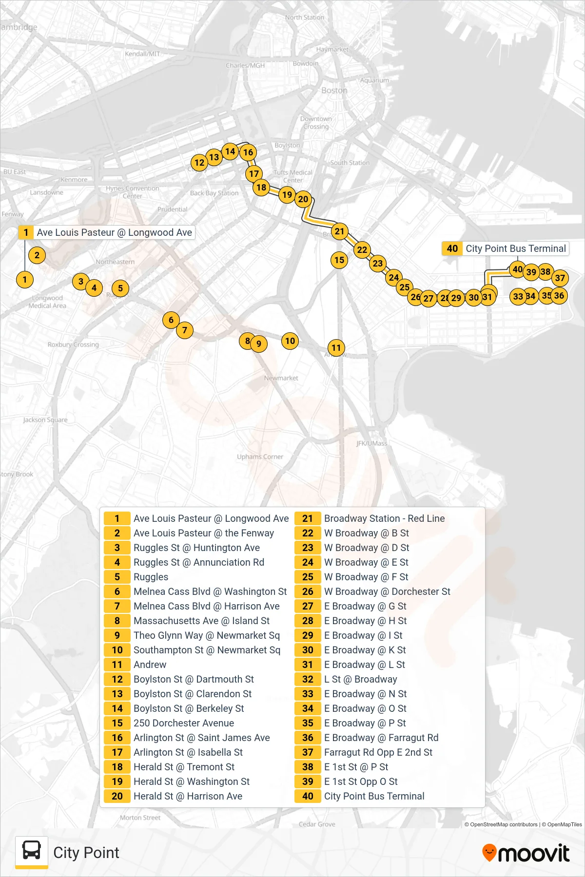
View the 9 route map and see all 9 stops along the route. The map of 9 shows where the bus travels and the location of each stop, making it easy to understand the entire route at a glance.
Explore MBTA routes on the map and see where MBTA bus services operate. Use the 9 map to find bus stops and see how the 9 connects different areas along its trip.
All 9 stops on the map are displayed in route order, helping you follow the 9 bus from the first stop to the last.
Stops list (9 - City Point)
- Ave Louis Pasteur @ Longwood Ave
- Ave Louis Pasteur @ the Fenway
- Ruggles St @ Huntington Ave
- Ruggles St @ Annunciation Rd
- Ruggles
- Melnea Cass Blvd @ Washington St
- Melnea Cass Blvd @ Harrison Ave
- Massachusetts Ave @ Island St
- Theo Glynn Way @ Newmarket Sq
- Southampton St @ Newmarket Sq
- Andrew
- Boylston St @ Dartmouth St
- Boylston St @ Clarendon St
- Boylston St @ Berkeley St
- 250 Dorchester Avenue
- Arlington St @ Saint James Ave
- Arlington St @ Isabella St
- Herald St @ Tremont St
- Herald St @ Washington St
- Herald St @ Harrison Ave
- Broadway Station - Red Line
- W Broadway @ B St
- W Broadway @ D St
- W Broadway @ E St
- W Broadway @ F St
- W Broadway @ Dorchester St
- E Broadway @ G St
- E Broadway @ H St
- E Broadway @ I St
- E Broadway @ K St
- E Broadway @ L St
- L St @ Broadway
- E Broadway @ N St
- E Broadway @ O St
- E Broadway @ P St
- E Broadway @ Farragut Rd
- Farragut Rd Opp E 2nd St
- E 1st St @ P St
- E 1st St Opp O St
- City Point Bus Terminal