
9 Bus Route Map
View the 9 route map and see all 9 stops along the route. The map of 9 shows where the bus travels and the location of each stop, making it easy to understand the entire route at a glance.
Explore Brockton Area Transit Authority routes on the map and see where Brockton Area Transit Authority bus services operate. Use the 9 map to find bus stops and see how the 9 connects different areas along its trip.
All 9 stops on the map are displayed in route order, helping you follow the 9 bus from the first stop to the last.
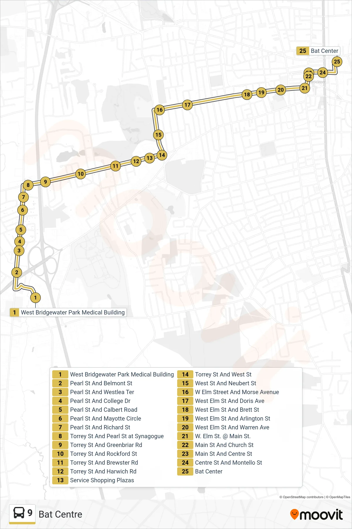
Stops list (9 - Bat Centre)
- West Bridgewater Park Medical Building
- Pearl St And Belmont St
- Pearl St And Westlea Ter
- Pearl St And College Dr
- Pearl St And Calbert Road
- Pearl St And Mayotte Circle
- Pearl St And Richard St
- Torrey St And Pearl St at Synagogue
- Torrey St And Greenbriar Rd
- Torrey St And Rockford St
- Torrey St And Brewster Rd
- Torrey St And Harwich Rd
- Service Shopping Plazas
- Torrey St And West St
- West St And Neubert St
- W Elm Street And Morse Avenue
- West Elm St And Doris Ave
- West Elm St And Brett St
- West Elm St And Arlington St
- West Elm St And Warren Ave
- W. Elm St. @ Main St.
- Main St And Church St
- Main St And Centre St
- Centre St And Montello St
- Bat Center