
9 Bus Route Map
View the 9 route map and see all 9 stops along the route. The map of 9 shows where the bus travels and the location of each stop, making it easy to understand the entire route at a glance.
Explore Koiviston Auto Jyväskylä Ltd routes on the map and see where Koiviston Auto Jyväskylä Ltd bus services operate. Use the 9 map to find bus stops and see how the 9 connects different areas along its trip.
All 9 stops on the map are displayed in route order, helping you follow the 9 bus from the first stop to the last.
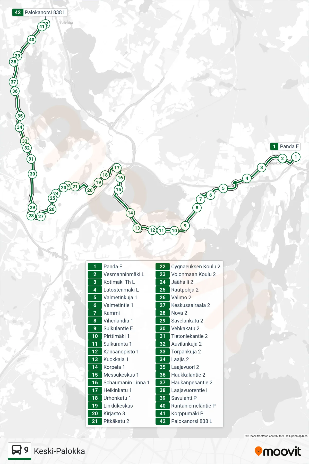
Stops list (9 - Central Palokka)
- Panda E
- Vesmanninmaki West
- Kotimäki Crossing W
- Latostenmäki West
- Valmetinkuja 1
- Valmetintie 1
- Kammi
- Viherlandia 1
- Sulkulantie South
- Pirttimaki 1
- Sulkuranta 1
- Folk School 1
- Kuokkala 1
- Korpela 1
- Exhibition Center 1
- Schauman Castle 1
- Heikinkatu 1
- Urhonkatu 1
- Link Center
- Library 3
- Long Street 2
- Cygnaeus School 2
- Voionmaa School 2
- Ice Hall 2
- Rautpohja 2
- Valimo 2
- Central Hospital 2
- Nova 2
- Savelankatu 2
- Vehkakatu 2
- Tietoniekantie 2
- Auvilankuja 2
- Torppa Alley 2
- Laajis 2
- Laajavuori 2
- Haukkalantie 2
- Hawk's Nest Road 2
- Laajavuorentie North
- Savulahti North
- Rantaniemeläntie N
- Korppumäki N
- Palokanorsi 838 W