
9 Bus Route Map
View the 9 route map and see all 9 stops along the route. The map of 9 shows where the bus travels and the location of each stop, making it easy to understand the entire route at a glance.
Explore Regensburger Verkehrsbetrieb routes on the map and see where Regensburger Verkehrsbetrieb bus services operate. Use the 9 map to find bus stops and see how the 9 connects different areas along its trip.
All 9 stops on the map are displayed in route order, helping you follow the 9 bus from the first stop to the last.
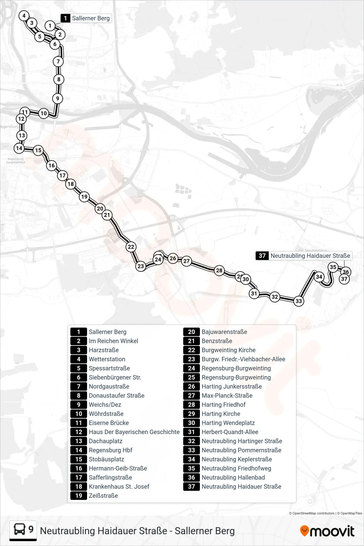
Stops list (9 - Neutraubling Haidauer Straße)
- Sallerner Berg
- Im Reichen Winkel
- Harzstraße
- Wetterstation
- Spessartstraße
- Siebenbürgener Str.
- Nordgaustraße
- Donaustaufer Straße
- Weichs/Dez
- Wöhrdstraße
- Eiserne Brücke
- Haus Der Bayerischen Geschichte
- Dachauplatz
- Regensburg Hbf
- Stobäusplatz
- Hermann-Geib-Straße
- Safferlingstraße
- Krankenhaus St. Josef
- Zeißstraße
- Bajuwarenstraße
- Benzstraße
- Burgweinting Kirche
- Burgw. Friedr.-Viehbacher-Allee
- Regensburg-Burgweinting
- Regensburg-Burgweinting
- Harting Junkersstraße
- Max-Planck-Straße
- Harting Friedhof
- Harting Kirche
- Harting Wendeplatz
- Herbert-Quandt-Allee
- Neutraubling Hartinger Straße
- Neutraubling Pommernstraße
- Neutraubling Keplerstraße
- Neutraubling Friedhofweg
- Neutraubling Hallenbad
- Neutraubling Haidauer Straße