
9 Bus Route Map
View the 9 route map and see all 9 stops along the route. The map of 9 shows where the bus travels and the location of each stop, making it easy to understand the entire route at a glance.
Explore GoRaleigh routes on the map and see where GoRaleigh bus services operate. Use the 9 map to find bus stops and see how the 9 connects different areas along its trip.
All 9 stops on the map are displayed in route order, helping you follow the 9 bus from the first stop to the last.
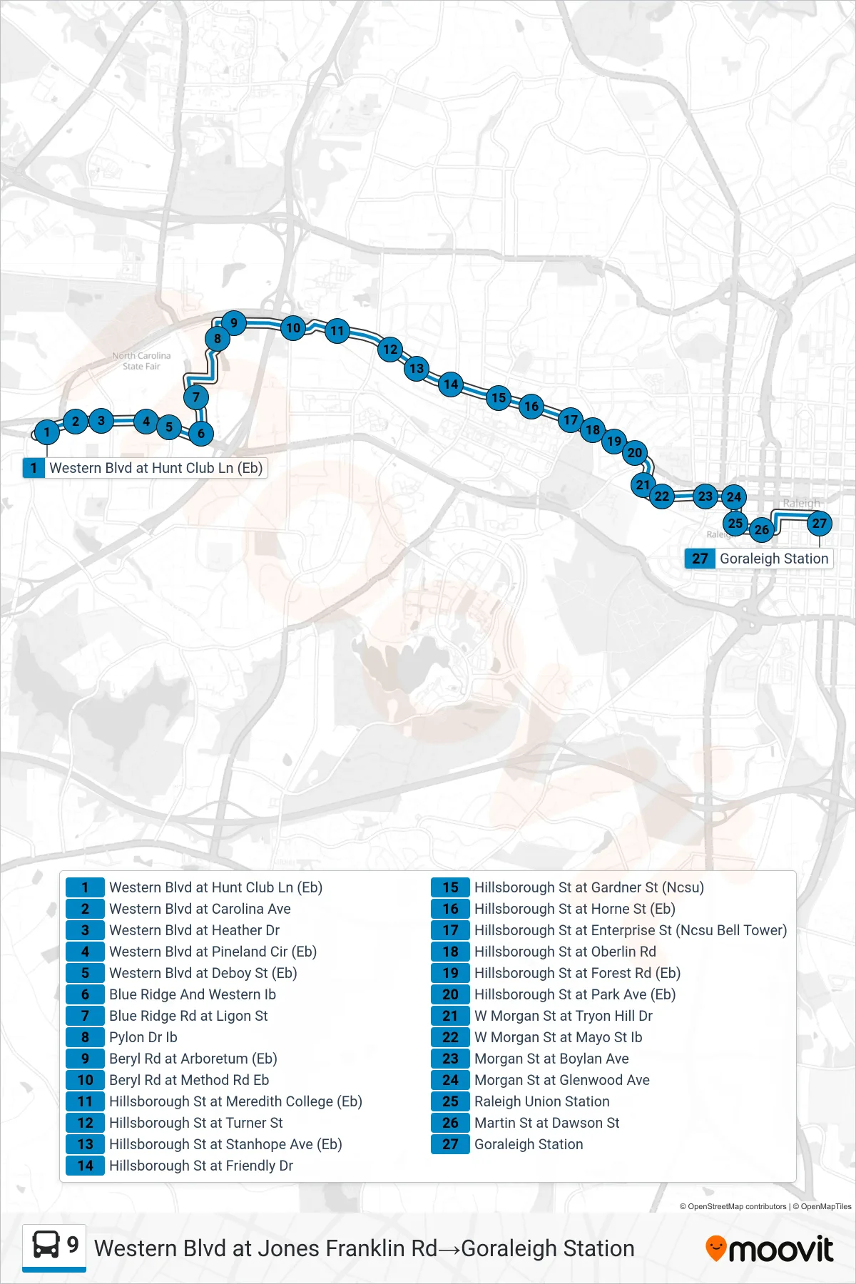
Stops list (9 - Western Blvd at Jones Franklin Rd→Goraleigh Station)
- Western Blvd at Hunt Club Ln (Eb)
- Western Blvd at Carolina Ave
- Western Blvd at Heather Dr
- Western Blvd at Pineland Cir (Eb)
- Western Blvd at Deboy St (Eb)
- Blue Ridge And Western Ib
- Blue Ridge Rd at Ligon St
- Pylon Dr Ib
- Beryl Rd at Arboretum (Eb)
- Beryl Rd at Method Rd Eb
- Hillsborough St at Meredith College (Eb)
- Hillsborough St at Turner St
- Hillsborough St at Stanhope Ave (Eb)
- Hillsborough St at Friendly Dr
- Hillsborough St at Gardner St (Ncsu)
- Hillsborough St at Horne St (Eb)
- Hillsborough St at Enterprise St (Ncsu Bell Tower)
- Hillsborough St at Oberlin Rd
- Hillsborough St at Forest Rd (Eb)
- Hillsborough St at Park Ave (Eb)
- W Morgan St at Tryon Hill Dr
- W Morgan St at Mayo St Ib
- Morgan St at Boylan Ave
- Morgan St at Glenwood Ave
- Raleigh Union Station
- Martin St at Dawson St
- Goraleigh Station