
9 Light Rail Route Map
View the 9 route map and see all 9 stops along the route. The map of 9 shows where the light rail travels and the location of each stop, making it easy to understand the entire route at a glance.
Explore KVB Kölner Verkehrs-Betriebe AG routes on the map and see where KVB Kölner Verkehrs-Betriebe AG light rail services operate. Use the 9 map to find light rail stations and see how the 9 connects different areas along its trip.
All 9 stops on the map are displayed in route order, helping you follow the 9 light rail from the first station to the last.
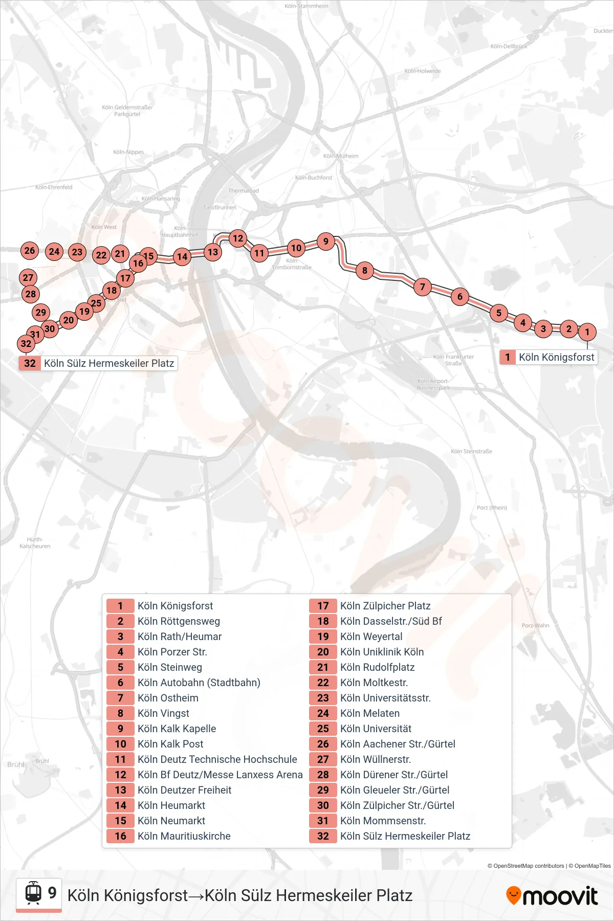

Stops list (9 - Köln Königsforst→Köln Sülz Hermeskeiler Platz)
- Köln Königsforst
- Köln Röttgensweg
- Köln Rath/Heumar
- Köln Porzer Str.
- Köln Steinweg
- Köln Autobahn (Stadtbahn)
- Köln Ostheim
- Köln Vingst
- Köln Kalk Kapelle
- Köln Kalk Post
- Köln Deutz Technische Hochschule
- Köln Bf Deutz/Messe Lanxess Arena
- Köln Deutzer Freiheit
- Köln Heumarkt
- Köln Neumarkt
- Köln Mauritiuskirche
- Köln Zülpicher Platz
- Köln Dasselstr./Süd Bf
- Köln Universität
- Köln Weyertal
- Köln Uniklinik Köln
- Köln Zülpicher Str./Gürtel
- Köln Mommsenstr.
- Köln Sülz Hermeskeiler Platz
Change direction
- Route Map - 9 - Köln Sülz Hermeskeiler Platz→Köln Königsforst
- Route Map - 9 - Köln Sülz Hermeskeiler Platz→Köln Neumarkt
- Route Map - 9 - Köln Königsforst→Köln Bf Deutz/Messe Lanxess Arena
- Route Map - 9 - Köln Bf Deutz/Messe Lanxess Arena→Köln Sülz Hermeskeiler Platz
- Route Map - 9 - Köln Neumarkt→Köln Sülz Hermeskeiler Platz
- Route Map - 9 - Köln Deutz Technische Hochschule→Köln Königsforst
- Route Map - 9 - Köln Bf Deutz/Messe Lanxess Arena→Köln Königsforst