
9 Bus Route Map
View the 9 route map and see all 9 stops along the route. The map of 9 shows where the bus travels and the location of each stop, making it easy to understand the entire route at a glance.
Explore Stadtwerke Hamm GmbH - Verkehrsbetrieb routes on the map and see where Stadtwerke Hamm GmbH - Verkehrsbetrieb bus services operate. Use the 9 map to find bus stops and see how the 9 connects different areas along its trip.
All 9 stops on the map are displayed in route order, helping you follow the 9 bus from the first stop to the last.
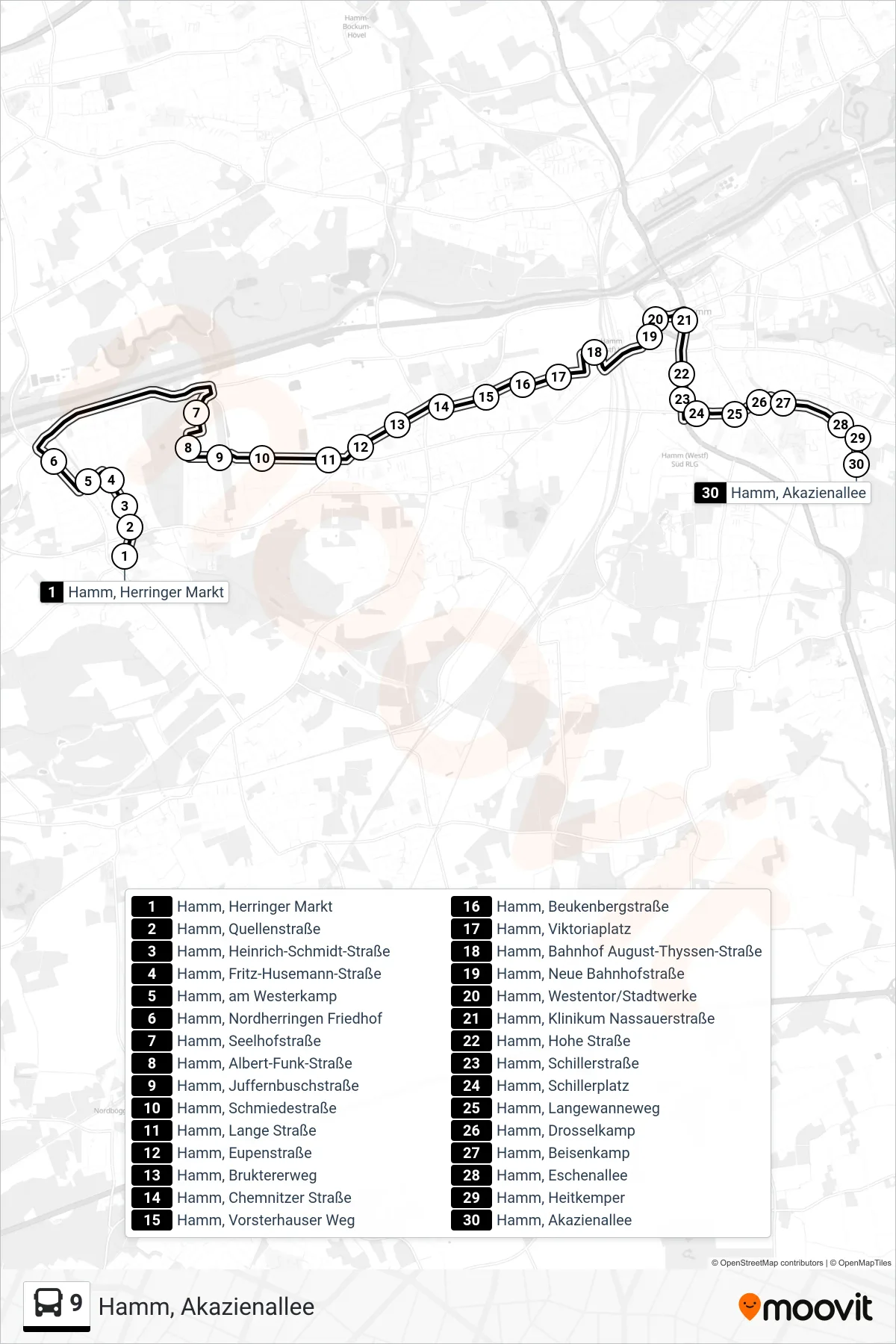
Stops list (9 - Hamm, Akazienallee)
- Hamm, Herringer Markt
- Hamm, Quellenstraße
- Hamm, Heinrich-Schmidt-Straße
- Hamm, Fritz-Husemann-Straße
- Hamm, am Westerkamp
- Hamm, Nordherringen Friedhof
- Hamm, Seelhofstraße
- Hamm, Albert-Funk-Straße
- Hamm, Juffernbuschstraße
- Hamm, Schmiedestraße
- Hamm, Lange Straße
- Hamm, Eupenstraße
- Hamm, Bruktererweg
- Hamm, Chemnitzer Straße
- Hamm, Vorsterhauser Weg
- Hamm, Beukenbergstraße
- Hamm, Viktoriaplatz
- Hamm, Bahnhof August-Thyssen-Straße
- Hamm, Neue Bahnhofstraße
- Hamm, Westentor/Stadtwerke
- Hamm, Klinikum Nassauerstraße
- Hamm, Hohe Straße
- Hamm, Schillerstraße
- Hamm, Schillerplatz
- Hamm, Langewanneweg
- Hamm, Drosselkamp
- Hamm, Beisenkamp
- Hamm, Eschenallee
- Hamm, Heitkemper
- Hamm, Akazienallee