
9 Bus Route Map
View the 9 route map and see all 9 stops along the route. The map of 9 shows where the bus travels and the location of each stop, making it easy to understand the entire route at a glance.
Explore County Connection routes on the map and see where County Connection bus services operate. Use the 9 map to find bus stops and see how the 9 connects different areas along its trip.
All 9 stops on the map are displayed in route order, helping you follow the 9 bus from the first stop to the last.
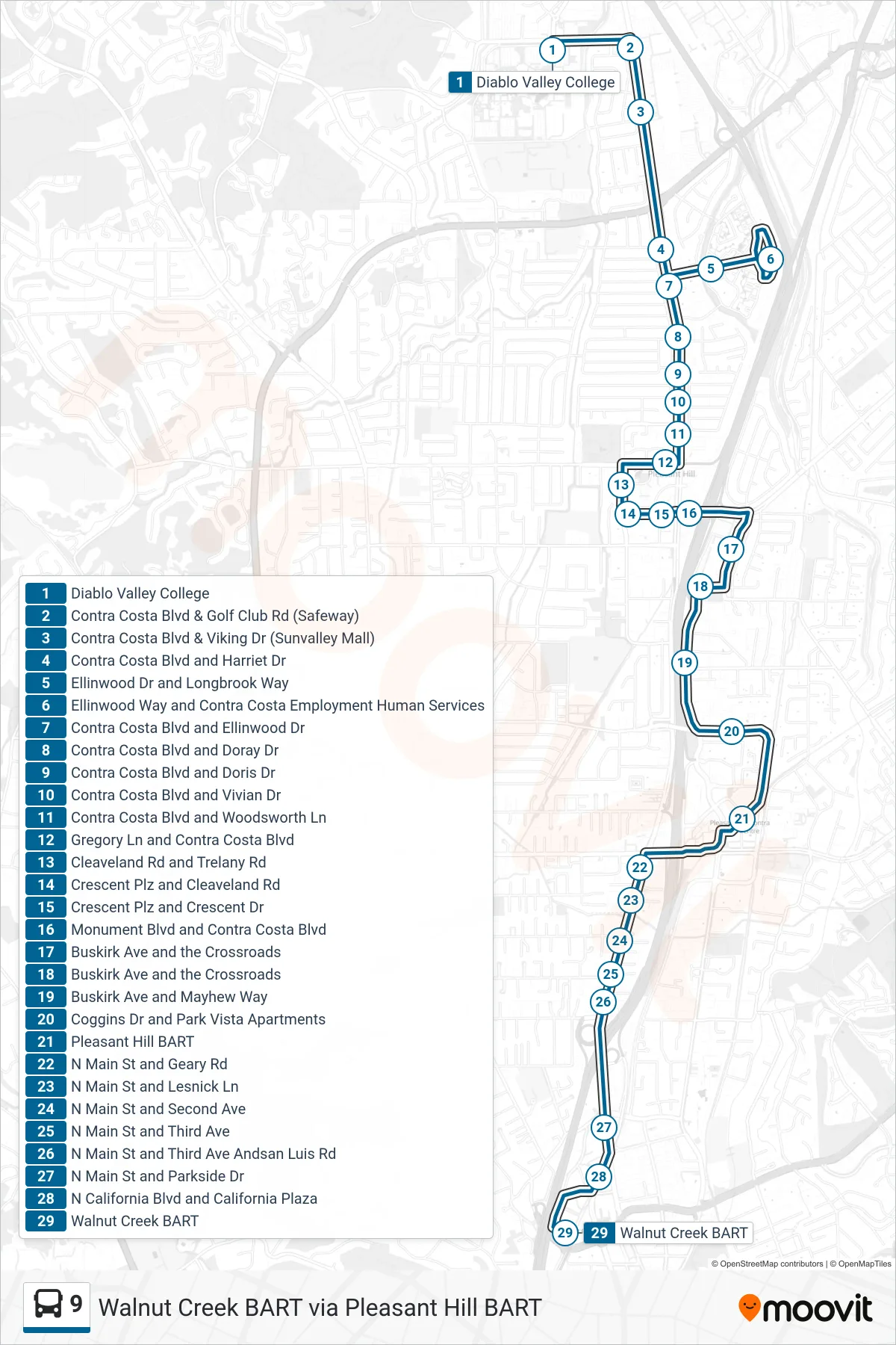
Stops list (9 - Walnut Creek BART via Pleasant Hill BART)
- Diablo Valley College
- Contra Costa Blvd & Golf Club Rd (Safeway)
- Contra Costa Blvd & Viking Dr (Sunvalley Mall)
- Contra Costa Blvd and Harriet Dr
- Ellinwood Dr and Longbrook Way
- Ellinwood Way and Contra Costa Employment Human Services
- Contra Costa Blvd and Ellinwood Dr
- Contra Costa Blvd and Doray Dr
- Contra Costa Blvd and Doris Dr
- Contra Costa Blvd and Vivian Dr
- Contra Costa Blvd and Woodsworth Ln
- Gregory Ln and Contra Costa Blvd
- Cleaveland Rd and Trelany Rd
- Crescent Plz and Cleaveland Rd
- Crescent Plz and Crescent Dr
- Monument Blvd and Contra Costa Blvd
- Buskirk Ave and the Crossroads
- Buskirk Ave and the Crossroads
- Buskirk Ave and Mayhew Way
- Coggins Dr and Park Vista Apartments
- Pleasant Hill BART
- N Main St and Geary Rd
- N Main St and Lesnick Ln
- N Main St and Second Ave
- N Main St and Third Ave
- N Main St and Third Ave Andsan Luis Rd
- N Main St and Parkside Dr
- N California Blvd and California Plaza
- Walnut Creek BART