
9 Bus Route Map
View the 9 route map and see all 9 stops along the route. The map of 9 shows where the bus travels and the location of each stop, making it easy to understand the entire route at a glance.
Explore Montgomery County Ride On routes on the map and see where Montgomery County Ride On bus services operate. Use the 9 map to find bus stops and see how the 9 connects different areas along its trip.
All 9 stops on the map are displayed in route order, helping you follow the 9 bus from the first stop to the last.
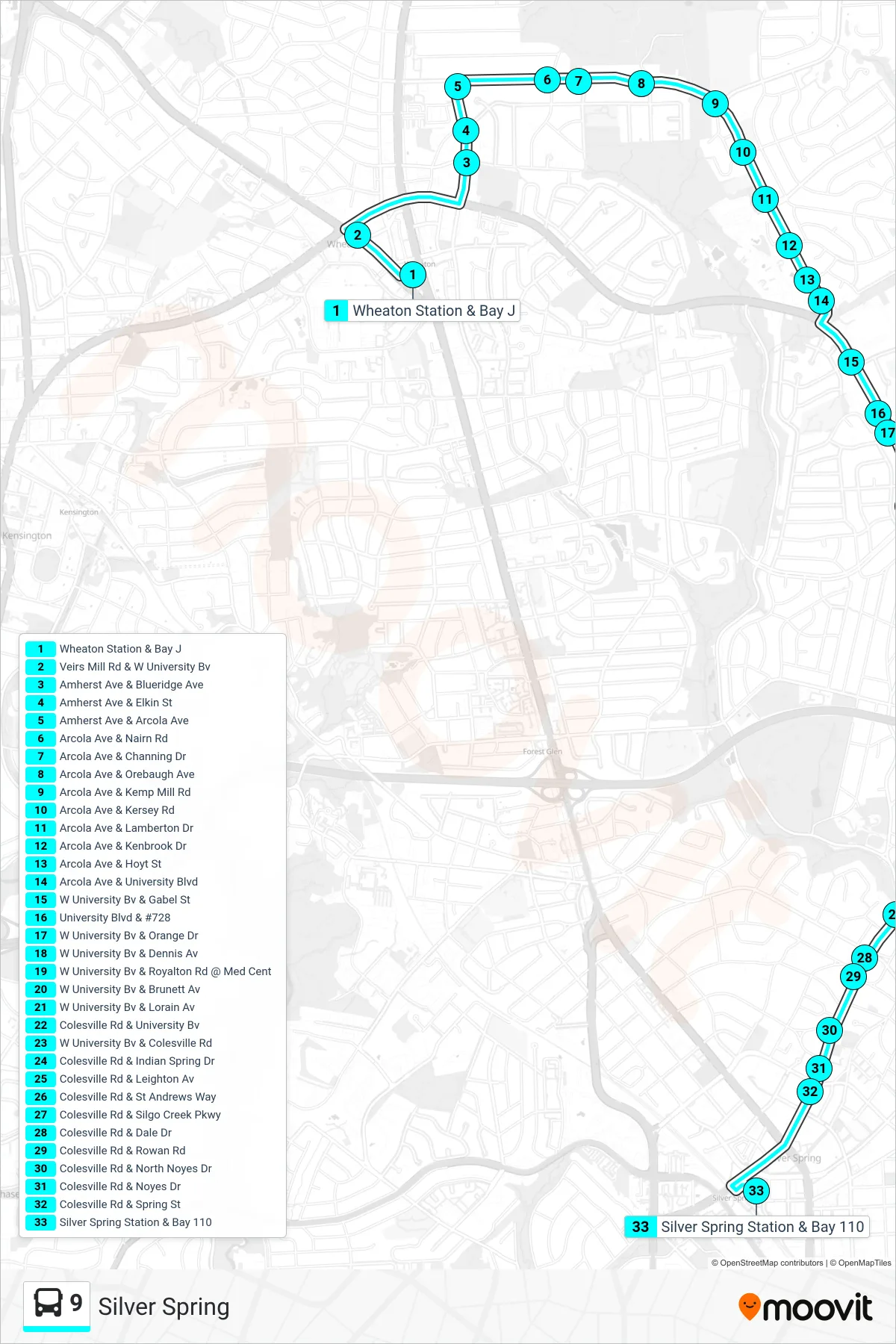
Stops list (9 - Silver Spring)
- Wheaton Station & Bay J
- Veirs Mill Rd & W University Bv
- Amherst Ave & Blueridge Ave
- Amherst Ave & Elkin St
- Amherst Ave & Arcola Ave
- Arcola Ave & Nairn Rd
- Arcola Ave & Channing Dr
- Arcola Ave & Orebaugh Ave
- Arcola Ave & Kemp Mill Rd
- Arcola Ave & Kersey Rd
- Arcola Ave & Lamberton Dr
- Arcola Ave & Kenbrook Dr
- Arcola Ave & Hoyt St
- Arcola Ave & University Blvd
- W University Bv & Gabel St
- University Blvd & #728
- W University Bv & Orange Dr
- W University Bv & Dennis Av
- W University Bv & Royalton Rd @ Med Cent
- W University Bv & Brunett Av
- W University Bv & Lorain Av
- Colesville Rd & University Bv
- W University Bv & Colesville Rd
- Colesville Rd & Indian Spring Dr
- Colesville Rd & Leighton Av
- Colesville Rd & St Andrews Way
- Colesville Rd & Silgo Creek Pkwy
- Colesville Rd & Dale Dr
- Colesville Rd & Rowan Rd
- Colesville Rd & North Noyes Dr
- Colesville Rd & Noyes Dr
- Colesville Rd & Spring St
- Silver Spring Station & Bay 110