
90 Bus Route Map
View the 90 route map and see all 90 stops along the route. The map of 90 shows where the bus travels and the location of each stop, making it easy to understand the entire route at a glance.
Explore ALV Oberhessen routes on the map and see where ALV Oberhessen bus services operate. Use the 90 map to find bus stops and see how the 90 connects different areas along its trip.
All 90 stops on the map are displayed in route order, helping you follow the 90 bus from the first stop to the last.
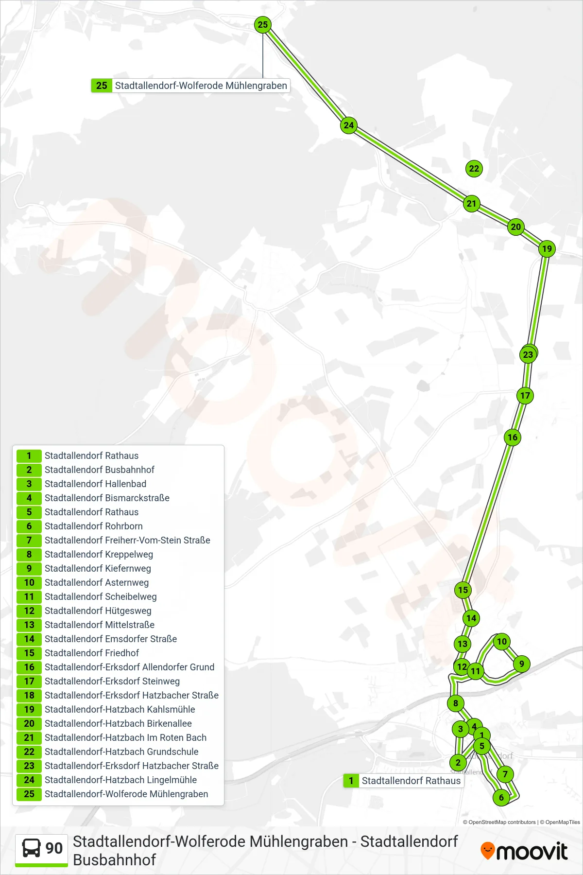
Stops list (90 - Stadtallendorf-Wolferode Mühlengraben)
- Stadtallendorf Rathaus
- Stadtallendorf Busbahnhof
- Stadtallendorf Hallenbad
- Stadtallendorf Bismarckstraße
- Stadtallendorf Rathaus
- Stadtallendorf Rohrborn
- Stadtallendorf Freiherr-Vom-Stein Straße
- Stadtallendorf Kreppelweg
- Stadtallendorf Kiefernweg
- Stadtallendorf Asternweg
- Stadtallendorf Scheibelweg
- Stadtallendorf Hütgesweg
- Stadtallendorf Mittelstraße
- Stadtallendorf Emsdorfer Straße
- Stadtallendorf Friedhof
- Stadtallendorf-Erksdorf Allendorfer Grund
- Stadtallendorf-Erksdorf Steinweg
- Stadtallendorf-Erksdorf Hatzbacher Straße
- Stadtallendorf-Hatzbach Kahlsmühle
- Stadtallendorf-Hatzbach Birkenallee
- Stadtallendorf-Hatzbach Im Roten Bach
- Stadtallendorf-Hatzbach Grundschule
- Stadtallendorf-Erksdorf Hatzbacher Straße
- Stadtallendorf-Hatzbach Lingelmühle
- Stadtallendorf-Wolferode Mühlengraben
Change direction
- Route Map - 90 - Amöneburg Ritterstraße
- Route Map - 90 - Stadtallendorf Georg-Büchner-Schule
- Route Map - 90 - Stadtallendorf-Erksdorf Grundschule
- Route Map - 90 - Stadtallendorf-Wolferode am Rasen
- Route Map - 90 - Wohratal-Halsdorf Mittelpunktschule
- Route Map - 90 - Stadtallendorf-Erksdorf Steinweg
- Route Map - 90 - Stadtallendorf Busbahnhof