
901 Bus Route Map
View the 901 route map and see all 901 stops along the route. The map of 901 shows where the bus travels and the location of each stop, making it easy to understand the entire route at a glance.
Explore BKK routes on the map and see where BKK bus services operate. Use the 901 map to find bus stops and see how the 901 connects different areas along its trip.
All 901 stops on the map are displayed in route order, helping you follow the 901 bus from the first stop to the last.
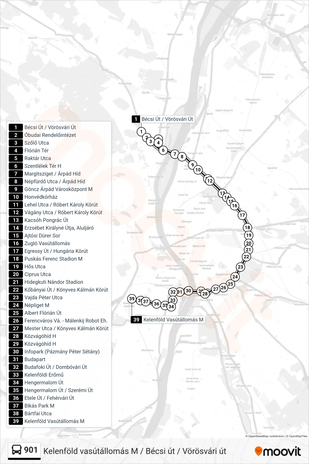
Stops list (901 - Kelenföld Vasútállomás M)
- Bécsi Út / Vörösvári Út
- Óbudai Rendelőintézet
- Szőlő Utca
- Flórián Tér
- Raktár Utca
- Szentlélek Tér H
- Margitsziget / Árpád Híd
- Népfürdő Utca / Árpád Híd
- Göncz Árpád Városközpont M
- Honvédkórház
- Lehel Utca / Róbert Károly Körút
- Vágány Utca / Róbert Károly Körút
- Kacsóh Pongrác Út
- Erzsébet Királyné Útja, Aluljáró
- Ajtósi Dürer Sor
- Zugló Vasútállomás
- Egressy Út / Hungária Körút
- Puskás Ferenc Stadion M
- Hős Utca
- Ciprus Utca
- Hidegkuti Nándor Stadion
- Kőbányai Út / Könyves Kálmán Körút
- Vajda Péter Utca
- Népliget M
- Albert Flórián Út
- Ferencváros Vá. - Málenkij Robot Eh.
- Mester Utca / Könyves Kálmán Körút
- Közvágóhíd H
- Közvágóhíd H
- Infopark (Pázmány Péter Sétány)
- Budapart
- Budafoki Út / Dombóvári Út
- Kelenföldi Erőmű
- Hengermalom Út
- Hengermalom Út / Szerémi Út
- Etele Út / Fehérvári Út
- Bikás Park M
- Bártfai Utca
- Kelenföld Vasútállomás M