
910 Bus Route Map
View the 910 route map and see all 910 stops along the route. The map of 910 shows where the bus travels and the location of each stop, making it easy to understand the entire route at a glance.
Explore DVG AG routes on the map and see where DVG AG bus services operate. Use the 910 map to find bus stops and see how the 910 connects different areas along its trip.
All 910 stops on the map are displayed in route order, helping you follow the 910 bus from the first stop to the last.
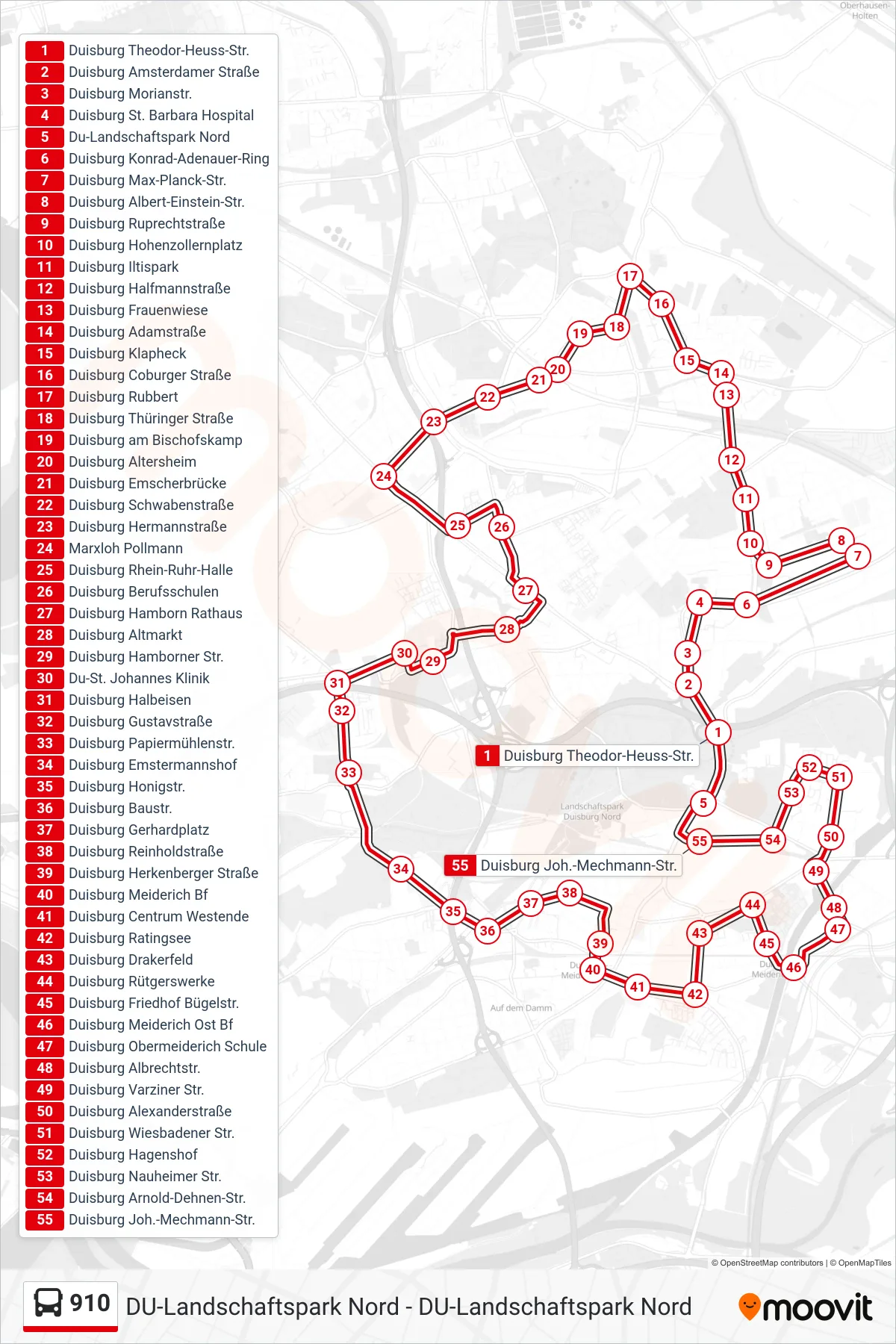
Stops list (910 - Du-Landschaftspark Nord)
- Duisburg Theodor-Heuss-Str.
- Duisburg Amsterdamer Straße
- Duisburg Morianstr.
- Duisburg St. Barbara Hospital
- Du-Landschaftspark Nord
- Duisburg Konrad-Adenauer-Ring
- Duisburg Max-Planck-Str.
- Duisburg Albert-Einstein-Str.
- Duisburg Ruprechtstraße
- Duisburg Hohenzollernplatz
- Duisburg Iltispark
- Duisburg Halfmannstraße
- Duisburg Frauenwiese
- Duisburg Adamstraße
- Duisburg Klapheck
- Duisburg Coburger Straße
- Duisburg Rubbert
- Duisburg Thüringer Straße
- Duisburg am Bischofskamp
- Duisburg Altersheim
- Duisburg Emscherbrücke
- Duisburg Schwabenstraße
- Duisburg Hermannstraße
- Marxloh Pollmann
- Duisburg Rhein-Ruhr-Halle
- Duisburg Berufsschulen
- Duisburg Hamborn Rathaus
- Duisburg Altmarkt
- Duisburg Hamborner Str.
- Du-St. Johannes Klinik
- Duisburg Halbeisen
- Duisburg Gustavstraße
- Duisburg Papiermühlenstr.
- Duisburg Emstermannshof
- Duisburg Honigstr.
- Duisburg Baustr.
- Duisburg Gerhardplatz
- Duisburg Reinholdstraße
- Duisburg Herkenberger Straße
- Duisburg Meiderich Bf
- Duisburg Centrum Westende
- Duisburg Ratingsee
- Duisburg Drakerfeld
- Duisburg Rütgerswerke
- Duisburg Friedhof Bügelstr.
- Duisburg Meiderich Ost Bf
- Duisburg Obermeiderich Schule
- Duisburg Albrechtstr.
- Duisburg Varziner Str.
- Duisburg Alexanderstraße
- Duisburg Wiesbadener Str.
- Duisburg Hagenshof
- Duisburg Nauheimer Str.
- Duisburg Arnold-Dehnen-Str.
- Duisburg Joh.-Mechmann-Str.