
911 Bus Route Map
View the 911 route map and see all 911 stops along the route. The map of 911 shows where the bus travels and the location of each stop, making it easy to understand the entire route at a glance.
Explore ATAC routes on the map and see where ATAC bus services operate. Use the 911 map to find bus stops and see how the 911 connects different areas along its trip.
All 911 stops on the map are displayed in route order, helping you follow the 911 bus from the first stop to the last.
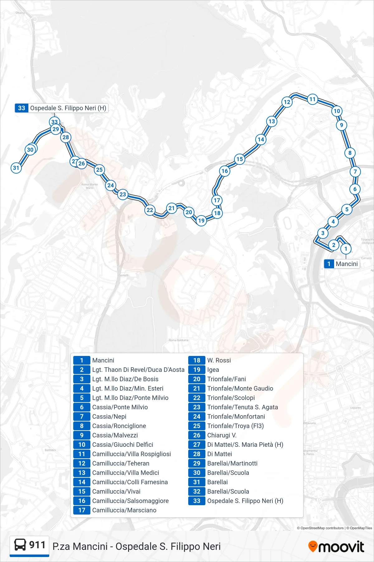
Stops list (911 - San Filippo Neri Hospital)
- Mancini
- Thaon Di Revel Waterfront/Duca D'Aosta
- Lungotevere Marshal Diaz/De Bosis
- Lungotevere Marshal Diaz/Foreign Ministry
- Lungotevere Marshal Diaz/Milvian Bridge
- Cassia/Milvian Bridge
- Cassia/Nepi
- Cassia/Ronciglione
- Cassia/Malvezzi
- Cassia/Giuochi Delfici
- Camilluccia/Villa Rospigliosi
- Camilluccia/Teheran
- Camilluccia/Villa Medici
- Camilluccia/Colli Farnesina
- Camilluccia/Vivai
- Camilluccia/Salsomaggiore
- Camilluccia/Marsciano
- W. Rossi
- Igea
- Trionfale/Fani
- Trionfale/Monte Gaudio
- Trionfale/Scolopi
- Trionfale/Tenuta Sant'Agata
- Trionfale/Monfortani
- Trionfale/Troya (Fl3)
- Chiarugi V.
- Di Mattei/St. Maria Pieta (Hospital)
- Di Mattei
- Barellai/Martinotti
- Barellai/School
- Barellai
- Barellai/School
- San Filippo Neri Hospital