
914 Bus Route Map
View the 914 route map and see all 914 stops along the route. The map of 914 shows where the bus travels and the location of each stop, making it easy to understand the entire route at a glance.
Explore Niederrheinische VKB routes on the map and see where Niederrheinische VKB bus services operate. Use the 914 map to find bus stops and see how the 914 connects different areas along its trip.
All 914 stops on the map are displayed in route order, helping you follow the 914 bus from the first stop to the last.
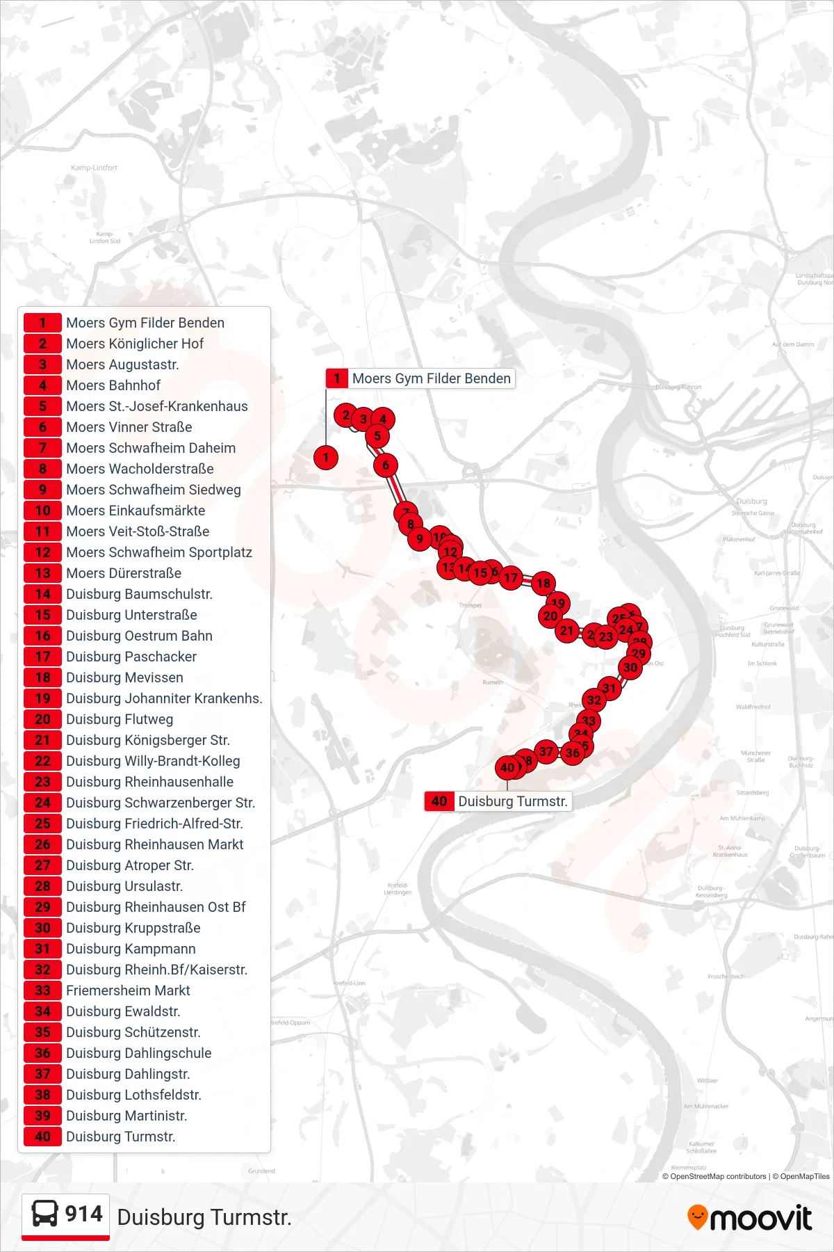
Stops list (914 - Duisburg Turmstr.)
- Moers Gym Filder Benden
- Moers Königlicher Hof
- Moers Augustastr.
- Moers Bahnhof
- Moers St.-Josef-Krankenhaus
- Moers Vinner Straße
- Moers Schwafheim Daheim
- Moers Wacholderstraße
- Moers Schwafheim Siedweg
- Moers Einkaufsmärkte
- Moers Veit-Stoß-Straße
- Moers Schwafheim Sportplatz
- Moers Dürerstraße
- Duisburg Baumschulstr.
- Duisburg Unterstraße
- Duisburg Oestrum Bahn
- Duisburg Paschacker
- Duisburg Mevissen
- Duisburg Johanniter Krankenhs.
- Duisburg Flutweg
- Duisburg Königsberger Str.
- Duisburg Willy-Brandt-Kolleg
- Duisburg Rheinhausenhalle
- Duisburg Schwarzenberger Str.
- Duisburg Friedrich-Alfred-Str.
- Duisburg Rheinhausen Markt
- Duisburg Atroper Str.
- Duisburg Ursulastr.
- Duisburg Rheinhausen Ost Bf
- Duisburg Kruppstraße
- Duisburg Kampmann
- Duisburg Rheinh.Bf/Kaiserstr.
- Friemersheim Markt
- Duisburg Ewaldstr.
- Duisburg Schützenstr.
- Duisburg Dahlingschule
- Duisburg Dahlingstr.
- Duisburg Lothsfeldstr.
- Duisburg Martinistr.
- Duisburg Turmstr.