
918 Bus Route Map
View the 918 route map and see all 918 stops along the route. The map of 918 shows where the bus travels and the location of each stop, making it easy to understand the entire route at a glance.
Explore Niederrheinische VKB routes on the map and see where Niederrheinische VKB bus services operate. Use the 918 map to find bus stops and see how the 918 connects different areas along its trip.
All 918 stops on the map are displayed in route order, helping you follow the 918 bus from the first stop to the last.
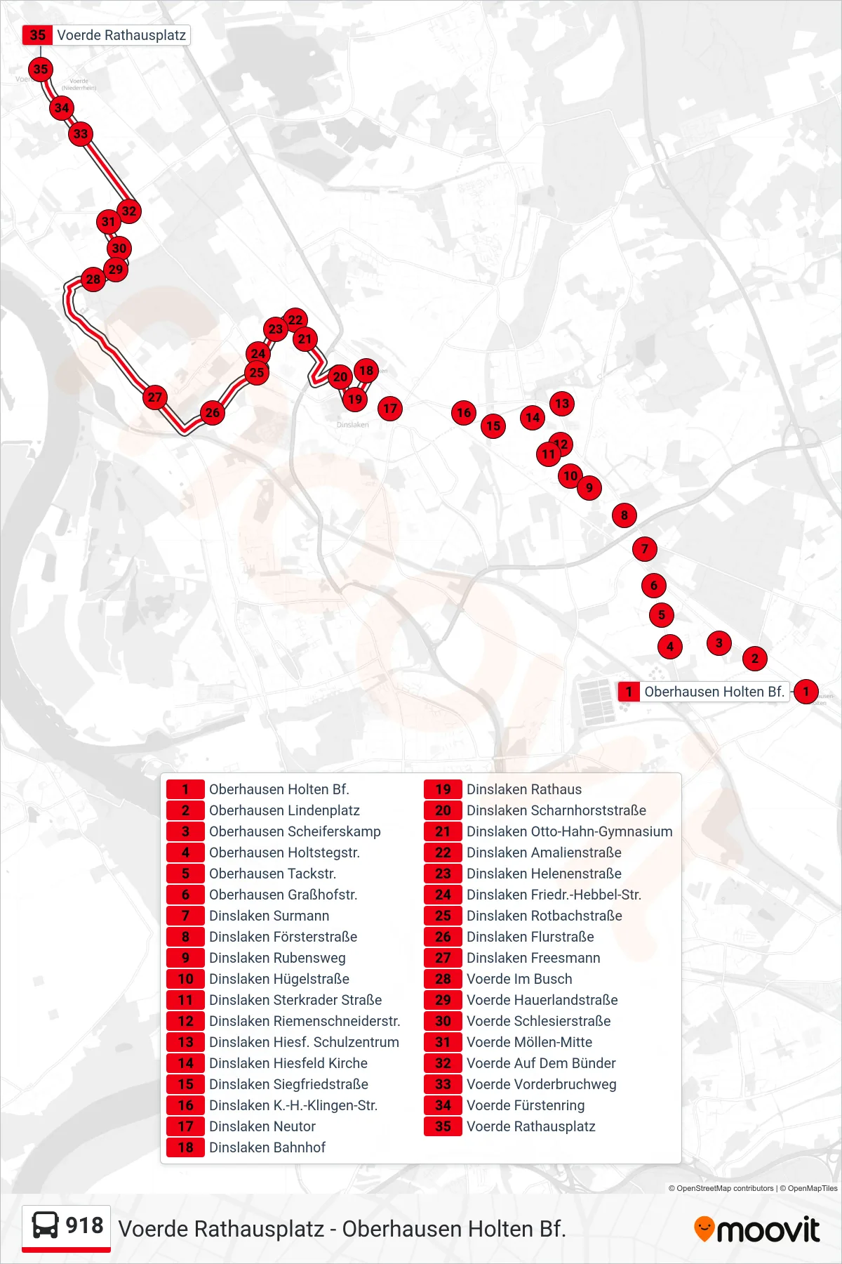
Stops list (918 - Voerde Rathausplatz)
- Oberhausen Holten Bf.
- Oberhausen Lindenplatz
- Oberhausen Scheiferskamp
- Oberhausen Holtstegstr.
- Oberhausen Tackstr.
- Oberhausen Graßhofstr.
- Dinslaken Surmann
- Dinslaken Försterstraße
- Dinslaken Rubensweg
- Dinslaken Hügelstraße
- Dinslaken Sterkrader Straße
- Dinslaken Riemenschneiderstr.
- Dinslaken Hiesf. Schulzentrum
- Dinslaken Hiesfeld Kirche
- Dinslaken Siegfriedstraße
- Dinslaken K.-H.-Klingen-Str.
- Dinslaken Neutor
- Dinslaken Bahnhof
- Dinslaken Rathaus
- Dinslaken Scharnhorststraße
- Dinslaken Otto-Hahn-Gymnasium
- Dinslaken Amalienstraße
- Dinslaken Helenenstraße
- Dinslaken Friedr.-Hebbel-Str.
- Dinslaken Rotbachstraße
- Dinslaken Flurstraße
- Dinslaken Freesmann
- Voerde Im Busch
- Voerde Hauerlandstraße
- Voerde Schlesierstraße
- Voerde Möllen-Mitte
- Voerde Auf Dem Bünder
- Voerde Vorderbruchweg
- Voerde Fürstenring
- Voerde Rathausplatz